
Page 25 - Australian Defence Magazine - July 2018
P. 25
airfields in our region, from all the major airports and air bases down to the smaller airfields as well.”
The Air Charting Section had previously been part of AIS-AF but was moved into the AGO in December 2016 as a result of one of the outcomes of the First Principles Review, which recommended that all Defence geo- spatial functions should be consolidated. However the small unit still functions as an integral team within the AIS-AF.
“The move into the AGO has been quite successful from our point of view, because they now sit from a standards point of view within that larger organisation,” WGCDR Dunstan added.
The AIS-AF team is complemented by personnel from IDS Australiasia, who sup- port the aeronautical production informa- tion system and also has two co-located CASG representatives from the Joint Com- mand Control Communications Comput- ers & Intelligence Systems Program Office (JC4ISPO) support organisation, who pro- vide system management and support.
Planning for Pitch Black
For Pitch Black and other major exercises which have a large aviation element to them, such as Talisman Sabre, AIS-AF pro- duces detailed Special Aeronautical Charts (SACs), as well as exercise-specific diagrams to go into the Aeronautical Information Package Supplement (AIP SUP), which is produced by Air Services Australia. The unit also produces a compilation of instrument flight procedure charts, combined with aero- drome facility information, to provide all ex- ercise participants with all the information they need on primary and diversion airfields.
For Pitch Black 2018 specifically, five charts are being produced, including a large overview of the entire exercise area, show- ing details which include topographical in- formation, changes to airspace, restricted areas, air to air refuelling tracks and civil air corridors. Other maps are larger scale charts of the major exercise airfields and training areas, Darwin, Tindal, Bradshaw, Delamere and Mt Bundey.
“The effort begins largely before Christ-
mas, in the October-November timeframe and for us to produce the charts we need to know things such as exactly what the airspace will be used for and what the di- version routes are going to be for example. We work collaboratively with the Joint Airspace Control Cell (JACC) within the Air and Space Operations Centre at Head- quarters, Joint Operations Command,” ex- plained James Mackenzie, AIS-AF produc- tion manager at the end of May. “They are the people doing the overall airspace plan- ning that we are most involved with, but the engagement began in earnest in early April and we are aiming to begin the review of the information on the charts in the next two weeks, where every feature will be com- pared with authoritative data sources and every single piece of information checked.”
Distribution of the final version of the charts (both in hardcopy and digital for- mat) to all exercise participants is expected to begin in early July, around two weeks before the first fighters arrive in the NT to begin the pre-exercise work-up.
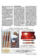
08892 Laser engraving.indd 1
www.australiandefence.com.au | July 2018 | 25 11/04/18 2:23 PM
