
Page 27 - 1996 AMA Spring
P. 27
ARMY MOUNTAINEER
AWalk. „ „ . in the Park
by Maj Nichols
The editorial in a recent edition of Army Mountaineer highlighted the lack of articles on small scale and UK based mountaineering activi ties. This piece, which is an account of 2 winter mountain walking days spent in the Lake District over my Christmas holidays, should help to redress the balance and may encourage others to try something similar. Both routes were adapted from W A Poucher. The Lakeland Peaks (Constable) and were chosen for their proximity to Kendal where I was staying with my in-laws and because I had not been on these routes before.
Day One. High Street (828m) from
Kentmere via Nan Bield Pass
returning by Kentmere Pike, 17
km, 57/2 hrs, adapted from Poucher
Routes 98, 101. Conditions were
perfect: cold, clear and very bright
with hardly a breath of wind. Snow
glare ensured that I kept my sunglasses on for much of the day. I saw no-one else until I reached Nan Bield Pass after which I was rarely out of site of other walkers. Easy paths led up on to the gen tly curving plateau that is High Street, where I stopped for lunch and took in the magnificent views. I reversed the route to Nan Bield Pass through ankle deep snow then pushed on up to the ridge leading to Kentmere Pike, which took me back to Kentmere along easy slopes. This proved to be an ideal warm-up route which combined satisfying views with easy navigation and good going.
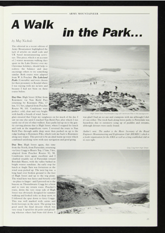
Day Two. High Street again, this time from the N orth, from Patterdale, returning via Grey Cragg to Hearts Top, 17 km, 5 hrs, adapted from Poucher Routes 92, 90. Conditions were again excellent and I climbed steadily out of Patterdale toward Boredale Hause, with the valley bathed in bright winter sunshine. An early stop for lunch at Angle Tarn was fortuitous as the wind soon picked up. The next leg was a long haul over broken ground to the foot of High Street and up to the trig point. The wind here was fierce and bitterly cold - no place to linger - and I pressed on to the beacon on Thornthwaite Cragg for a brew and to view my return route. Poucher’s route, down the very steep side of High Street was obviously designed for summer walking and looked risky in deep snow, so I followed the spur down to Grey Craggs. This was well marked with cairns and fresh footsteps in the snow. The going was good until the final descent which was very steep. I opted for ski poles and glisad- ing whereas others had bum-slid down. I
High Street from Thornthwaite Crag with Ventmore Pike in the background..
was glad I had an ice axe and crampons with me although I did n’t use either. The treck back along forest paths to Patterdale was hazardous due to extensive icing up of puddles and streams, although detours were easily found.
Author’s note: The author is the Meets Secretary of the Royal Engineers Mountaineering and Exploration Club (REMEC) which is afeeder organisationfor theAMA as well as a long established club in its own right.
Gray Crag from High Street.
25
