
Page 34 - 2006/07 AMA Winter
P. 34
mountain hike. Few long dis tance hikes offer the variety and grandeur of landscape as
Our third day was the hardest,
IBEX DRAGON By Maj R S Metcalfe
The European Alps are www.wetterzentrale.de/top-
navigation and route selection lessons to be reviewed that morning. We ate a quick lunch near the Cabane Col du Mille, and donated an apple core to the mule that had brought supplies in to the refuge that morning. A straightforward walk in to the Cabane Brunet (2103M) was
glacier; this was clear on the ground from the eastern approach, not from the west. However we got on with no problems, and climbed on to Col de Prafleuri (2987M) to enjoy spectacular views of the Aiguilles Rouges d'Arolla. At the Cabane de Prafleuri, much of the space on the tables was occupied by stuffed animals; we shared our simple supper watched by beady eyes.
On the final day of our trek we crossed the Col des Roux (2804M) to take in a stunning view of the Lac des Dix, above the tallest dam in the world. The Dix supplies 18% of Switzerland’s electricity requirements in winter. The marmots (as well as the prized cows) looked on as we made easy progress south and east towards Arolla. Our last col, the Col de Reidmatten (2919M), was ascended by two iron ladders fixed to the rock face. All of us
karten/fsfaxsem.htmI
reasonably close to UK,
and can offer a good
mountain challenge for thosTehe French mountain rescue
with little time and a limited services are provided by
budget. The Haute Route mountain police (the CRS),
was established almost a hun gendarmes and fire officers.
dred years ago as a high By contrast, the Swiss moun
mountaineering route that tain rescue is private and
linked together two of reimbursed by visitors' insur
Europe's premier moun ance fees. You therefore punctuated by views of
taineering centres, Chamonix need proper specialist moun and Zermatt. It was then tain insurance.
developed into a ski route and
more recently a high-level
Verbier (for the very rich) and Sarreyer, with the next day’s destination, Cabane du Mont Fort, clearly visible below the Monts du Cion.
Our first day took us from le
Peuty (1328M) to the Chalet
du G lacier (1583M ) on a
deceptively easy leg. Then
this route. Beginning in the harder work started, on with a total of 3 hours 57 min Chamonix at the foot of Mont the climb via Vesevey (a tiny utes added for ascents and Blanc, Western Europe's deserted stone refuge at descents. We walked down highest peak, the Haute 2096M) to the Fenetre 670M to the intermediate Route winds its way through d’Arpette (2665M). We were hydro-electric installation at the Swiss canton of Valais. just getting our mountain legs, Fionnay, and ascended from really, and were grateful that there to Lac Louvie. The
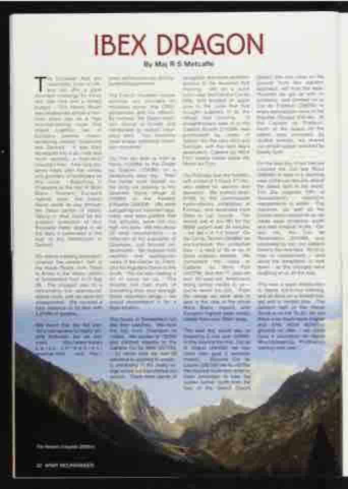
Taking in what could be the
greatest collection of four
thousand meter peaks in all
the Alps, it culminates at the
foot of the Matterhorn in reflection of the popularity of
Zermatt.
Our Alpine trekking expedition
covered the western half of
the Haute Route, from Trient
to Arolla in the Valais canton
of Switzerland from 9-13 Sep
06. The prospect was for a Arpette Hut had more of
demanding but spectacular everything than your average
Alpine route, and we were not Swiss mountain refuge - we
disappointed. We covered a would recommend it for a take in the view of the whole
total distance of 55.5km with base location. 5,810M of ascents.
The buses in Switzerland run We found that the hut war like their watches. We took
Mont Blanc massif, with Europe’s highest peak clearly visible from over 40km away.
The next day would see us breasting 3 cols over 2900M. A little beyond the first, Col de la Chaux (2940M) we saw more ibex (just 5 bachelor males). Beyond Col de Louvie (2921M) we found that the marked route had recently been amended, to take the walker further north from the foot of the Grand Desert
dens had access to highly reli able forecasts, but we also used http://www.meteo s w i s s . c h / w e b / e n /
the bus from Champex to Liddes. We started at 1300M and climbed steadily to the Cabane Col du Mille (2472M)
yeather.html and http:// - by which time we had all admitted to aspiring to proper ty ownership in the pretty vil lage where we had started our ascent. There were plenty of
the altitudes were not too record (set in Jun 06) for the
high, too early. We met about 30 other mountaineers - a
880M ascent was 34 minutes
- we did it in 1.5 hours! On
the Col du Termin (2648M) we
encountered the protected
ibex- aherdof30orsoof
these majestic animals. We had to concentrate - and
Champex, just beyond our destination. W e enjoyed mild weather and spectacular views of the Glacier du Trient, and the Aiguilees Dores to the south. The ice was making a lot of noise for us. The
completed the route to Cabane du Mont Fort (2457M), and met 77 year-old and 65-year-old Americans doing similar routes to us - you’re never too old... From the refuge we were able to
avoid the temptation to look down - as the choughs were laughing at us all the way.
This was a good introduction to Alpine hut-to-hut trekking, and all done on a limited bud get and in limited time. The eastern half of the Haute Route Is on the “to do” list, but there Is so much more (higher and onto more technical ground) on offer - we could have 4 volunteers for Alpine Mountaineering Proficiency training next year...
