
Page 19 - Loodswezen December 2017
P. 19
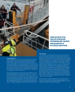
                THE ROUTE VIA PILOT STATION STEENBANK SAVES MEGASHIPS A 40-MILE DETOUR
 SHORT AND FAST
In the wheelhouse of the Northern Ocean, Siewe greets the Swedish captain of the ship which sails under the  ag of the Faroe Islands. Straight away, the captain asks Siewe about the proposed route.
Given the ship’s length (137 metres) and draught (8.5 metres) and the current tidal conditions, the so-called Oostgatroute just off the coast of Zeeland is the shortest and therefore fastest option, says the pilot. And since Siewe has just started his shift, he will personally take the ship to the terminal near Terneuzen, ten miles past Vlissingen. Changing pilots at Vlissingen is not necessary. After all, Dutch pilots are multivalent and can operate both on the river and at sea.
Ships of 260 to 300 metres long and with draughts between 7.5 and 10 metres (depending on the tidal conditions) can in most cases access the Western Scheldt via the Oostgatroute. Larger ships - more and more common due to the increase in scale in the shipping sector - take the slightly longer Westrondroute from pilot station Steenbank. Siewe: “Thanks to our operational approach at Steenbank, with a swath at sea 24/7, megaships approaching from the north that are bound for the Western Scheldt no longer need to use the southern pilot station Wan- delaar of our Belgian colleagues. That saves them a 40-mile detour.”
ON THE MAP
Over the years, the North Sea has become busier and busier, and not just in terms of shipping traf c. Earlier industrial activities such as oil and gas extraction are currently being overtaken by the construction of space-consuming wind farms. This not only puts pressure on traditional uses such as  shing, but also on the corridors used by seagoing vessels to access the ports and on the available anchoring space. In 2017, the governments of Belgium and the Netherlands consequently decided to adjust the shipping routes. As of June 1, a new, continuous routing system has been in effect from France to Germany. This among other things comprises the designation of new precautionary areas, the adjustment of anchoring areas, and, where appropriate, the separation of inbound and outbound traf c. From and to pilot station Steenbank, the new measures mainly affect the Westrondroute which runs past
the planned wind farms. The new routes help ships to navigate, which bene ts safety at sea and reduces the risk of environmental pollution. Siewe: “Safety  rst, always. In the preparatory phase, we were able to offer our input as to the manoeuvring space that we deem absolutely necessary for the ever-larger ships. Bad weather situations in particular come to mind in this respect.”
Siewe concludes: “Through the IMO, the new route has been put on the international sea charts. All captains and route planners in the world can now easily see just how sophisticated and safe it is to access the Western Scheldt via pilot station Steenbank.”
19
