
Page 34 - Black Range Naturalist, Vol. 3, No. 1
P. 34
example, in developing the EMMS it was discovered that a communication problem between two components was created by a data bit size limitation of one of the components. Developing a different data packet system solved that problem. Once raw data are sent from the individual sensors to the base station they are stored on a local data card in the EMMS configuration. As noted below, other configurations could involve the transmission of data to alert systems or to widely distributed locations where data are stored from very large geographic areas. Regardless of where and how the raw data are stored, the data packet system developed to overcome this issue is such that the raw data can be imported directly into Microsoft Excel and analyzed.
In another case, a sensor array experienced communication issues when the radios of the individual sensor nodes were interfering with each other because they were all trying to transmit at the same time. The (rather sweet) solution was to have each radio transmit at different times (milliseconds apart) using a system based on prime numbers.
But with all that consternation in the past (future system enhancements will undoubtedly come with their own consternations) the system is low cost. Low cost, in this case, is defined as low initial cost, low maintenance cost (either repair or changeout of individual components), ease of use, and low resource requirements during use. Each of these cost parameters is important in basic research, public safety applications, and in systems which announce pending infrastructure failure - for instance. Low cost means that such systems are more likely to be deployed and deployed more aggressively (more units used as well as units placed in locations where extreme damage to the unit is likely). Such a change in deployment protocol will yield more raw data than are currently available to users, more data from a wider variety of local situations.
More raw data inputs also enable greater data integrity; cross checks and verification become possible in situations where they might not have been possible in the past.
Barnes is assessing the system’s ability to determine earth movement in his field tests. The system is able to measure both the angle of movement and the speed of movement. There are numerous applications where this basic system could be utilized; land slides, land slips, subsidence, and avalanche monitoring. In our area, other uses, like automated flash flood warning systems, readily come to mind.
In every application of sensory systems, researchers, infrastructure managers, and safety officials are concerned about the reliability and redundancy of their systems. Often they are forced to choose between the two because of cost. A low-cost system tested for reliability at the first stage and which can be easily modified if a component fails in the field by simply putting a new wireless node on the ground and picking up the malfunctioning unit, addresses many
reliability issues. Such maintenance capabilities help assure long term reliability.
Since the costs of these systems are low, redundancy can be achieved within a system (mesh networks, multiple sensor trees, etc.) and completely independent systems can be deployed in the same area (the ultimate in redundancy). Given the consequence of system failure for any or all users, the reliability/redundancy attributes of a low cost system are significant.
Of course, no system is perfect; reliability checks and redundancy schemes help address that basic fact. Sensor systems placed in circumstances where external forces are expected to destroy them at the moment the sensor reports the external activity can make such systems very expensive in broad applications. Forcing the cost point of each system downward is a goal worth pursuing.
Every project, every manager, every researcher has a different risk profile and an understanding of the level of risk he/she is willing to live with on an ongoing basis. The EMMS and similar systems can be tailored to the risk profile of the user’s project.
And last, not least, is the fact that the system is not built around a particular type of sensor, and the sensor can be changed out. That means such a system can be used for many applications with only a minor modification.
The development of this system fills me with awe about the potentials. Automated warning systems being fed raw data from numerous dispersed sensor nodes can save lives and money, decrease grief and economic disruption, and enhance the research capabilities of many researchers. This system is begging to be enhanced, and the Black Range has been on the ground floor.
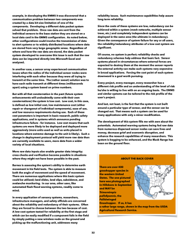
ABOUT THE BACK COVER
There are over 400
grasshopper species in
the western United
States. The one pictured
here was photographed
in Hillsboro in September
and MAY be
Trimerotropis
pallidipennis, the
Pallidwinged
Grasshopper. If so, it has
a rather large range, shown in the map from the USDA Agricultural Research Service.
32
