
Page 33 - Cooke's Peak - Pasaron Por Aqui
P. 33
could not be brought to and 73 bay terminally defeated.
A map of “The Kingdom of New Mexico,” drawn by colonial New Mexico’s foremost cartographer, Don Bernardo de Miera y Pacheco, in about 1758 to 1760 and dedicated to Senor Don Francisco Antonio Marin del Valle, the Governor and Captain General of New Mexico, clearly depicted a sharp peak called Cerro de los Remedias. The map also illustrated a river called Rio de las Mimbres west of the peak and showed it
across the plains to Nueva Vizcaya to the southern end of the Hatchet Mountains just below the present New Mexico border. Here the road forked again; one branch turned south toward the presidios of Janos and San Buenaventura, and the other angled northwest into the New Mexico panhandle, through San Luis Pass, across the Animas Valley, and down through Guadalupe Canyon to San Bernardino where a presidio existed from 1775 to 1780. At this point travelers could go south to Fronteras or Arizpe or continue westward to the San Pedro River and beyond.79
In considering the various potential routes to Sonora, de Anza was acutely aware of the need for experienced guides because precise knowledge of trails, mountain passes, and watering places was scarce. In late 1779, de Anza asked Commandant General de Croix for the services of two Sonoran soldiers who had served under him during the Menchero Gila campaign in the mid- 1700s when de Anza had been at the Tucson presidio. Unfortunately, Manuel Chacon had died, and Juan
disappearing into a dry lake south of the mountain.
74
This mountain has been confirmed as Cooke’s Peak,
and it has been further indicated that La Virgin de los
Remedios (the Virgin of the Remedies) was a very
popular Spanish saint for whom many things have been
75
named.
In the late 1700s and early 1800s, several exploratory
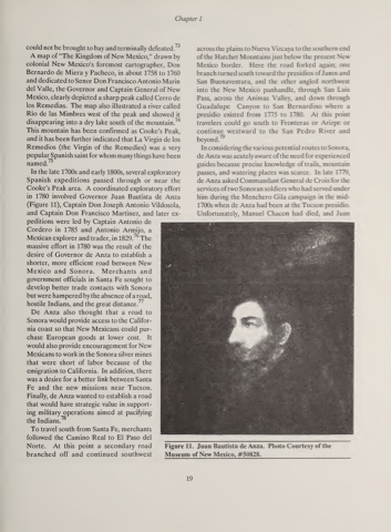
Spanish expeditions passed through or near the Cooke’s Peak area. A coordinated exploratory effort in 1780 involved Governor Juan Bautista de Anza (Figure 11), Captain Don Joseph Antonio Vildosola, and Captain Don Francisco Martinez, and later ex- peditions were led by Captain Antonio de
Cordero in 1785 and Antonio Armijo, a
7(7
Mexican explorer and trader, in 1829. massive effort in 1780 was the result of the desire of Governor de Anza to establish a shorter, more efficient road between New Mexico and Sonora. Merchants and government officials in Santa Fe sought to develop better trade contacts with Sonora but were hampered by the absence of a road,
77 hostile Indians, and the great distance.
De Anza also thought that a road to Sonora would provide access to the Califor- nia coast so that New Mexicans could pur- chase European goods at lower cost. It would also provide encouragement for New Mexicans to work in the Sonora silver mines that were short of labor because of the emigration to California. In addition, there was a desire for a better link between Santa Fe and the new missions near Tucson. Finally, de Anza wanted to establish a road that would have strategic value in support- ing military operations aimed at pacifying
78 the Indians.
To travel south from Santa Fe, merchants followed the Camino Real to El Paso del Norte. At this point a secondary road branched off and continued southwest
The
Chapter 1
Figure 11. Juan Bautista de Anza. Photo Courtesy of the Museum of New Mexico, #50828.
19
