
Page 67 - Cooke's Peak - Pasaron Por Aqui
P. 67
tlements. The first Anglo settlement, Benjamin Franklin Coons’ Rancho (originally named Ponce’s Rancho by 1827 land grant settler Juan Maria Ponce de Leon), situated at present-day downtown El Paso, had been the military post for about two years under Major Jefferson van Horne and was largely unoccupied. The second settlement, Magoffinville, founded by Kentuckian James Wiley Magoffin, was located about one and one-half miles down the river. It was the principal American village at the time, located near the present-day intersection of Magof- fin and Willow streets, and complete with a large
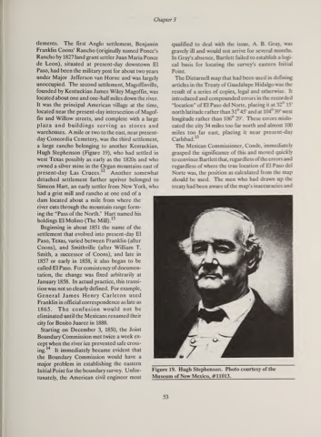
plaza and buildings serving as stores and warehouses. A mile or two to the east, near present- day Concordia Cemetery, was the third settlement, a large rancho belonging to another Kentuckian, Hugh Stephenson (Figure 19), who had settled in west Texas possibly as early as the 1820s and who owned a silver mine in the Organ mountains east of present-day Las Cruces. 12 Another somewhat detached settlement farther upriver belonged to Simeon Hart, an early settler from New York, who had a grist mill and rancho at one end of a
dam located about a mile from where the river cuts through the mountain range form- ing the “Pass of the North." Hart named his
13 holdings El Molino (The Mill).
Beginning in about 1851 the name of the settlement that evolved into present-day El Paso, Texas, varied between Franklin (after Coons), and Smithville (after William T. Smith, a successor of Coons), and late in 1857 or early in 1858, it also began to be called El Paso. For consistency of documen- tation, the change was fixed arbitrarily at January 1858. In actual practice, this transi- tion was not so clearly defined. For example, General James Henry Carleton used Franklin in official correspondence as late as 1865. The confusion would not be eliminated until the Mexicans renamed their city for Benito Juarez in 1888.
Starting on December 3, 1850, the Joint
Boundary Commission met twice a week ex-
cept when the river ice prevented safe cross-
14
qualified to deal with the issue, A. B. Gray, was gravely ill and would not arrive for several months. In Gray’s absence, Bartlett failed to establish a logi- cal basis for locating the survey’s eastern Initial Point.
The Disturnell map that had been used in defining
articles in the Treaty of Guadalupe Hidalgo was the
result of a series of copies, legal and otherwise. It
introduced and compounded errors in the recorded
“location” of El Paso del Norte, placing it at 32° 15’
north latitude rather than 31° 45’ and at 104° 39’ west
longitude rather than 106° 29’. These errors mislo-
cated the city 34 miles too far north and almost 100
miles too far east, placing it near present-day
15
Carlsbad.
The Mexican Commissioner, Conde, immediately
grasped the significance of this and moved quickly to convince Bartlett that, regardless of the errors and regardless of where the true location of El Paso del Norte was, the position as calculated from the map shouldbeused. Themenwhohaddrawnupthe treaty had been aware of the map’s inaccuracies and
It immediately became evident that the Boundary Commission would have a major problem in establishing the eastern Initial Point for the boundary survey. Unfor- tunately, the American civil engineer most
ing.
Chapter 3
Figure 19. Hugh Stephenson. Photo courtesy of the Museum of New Mexico, #11013.
53
