
Page 73 - Vol. 1 Walks In The Black Range - 2nd Edition
P. 73
In 1920,The Mines Handbook reported: “Sierra Consolidated Mining Co. (is) out of business. Property taken over by Statehood Mines Co., both of which companies were reported into bankruptcy through incompetent management and spectacular get-rich-quick financing.
Mine now operated by the Snake and Opportunity Mines Co.” (see exert at the bottom of the previous page - “The Mines Handbook”, by Walter Weed, Volume. 14, 1920, p. 1258.)
These mines changed hands frequently, with each new owner reporting the same activities and the same prospect of substantial profits. What was happening? See “Played Out In Minneapolis: The Rise? and Fall? of a Hillsboro Mining Venture" by Mark Thompson, for one possible scenario (February 2014 issue of Guajalotes, Zopilotes, y Paisanos - Newsletter of the Hillsboro Historical Society). Was Sierra Consolidated plagued by bad business decisions or was it just another mining fraud?
Much of the mining money of the west was made from (not by) investors responding to prospectus like those floated by Sierra Consolidated. Ferreting out the real from the fraud was often very difficult. At roughly the same time that the Sierra Consolidated Gold Mining Company was circulating its prospectus, “the postoffice department lately issued a fraud order against the Hillsboro Consolidated Mines Co., alleging that the company purchased a defunct mine in the Hillsboro camp for $9,950, capitalized the company for $2,000,000 and sold a large amount of stock, the money from which went into the pockets of the promoters rather than into the development of the property.” (“The Mining Reporter”, Volume 56, p. 411, October 31, 1907.)
There are many who will claim to see parallels between the past and present. I simply note that it is often difficult to tell bad business decisions from fraud and hopes/aspirations from reality. In the end, however, there are more than a few crooks in our local history.
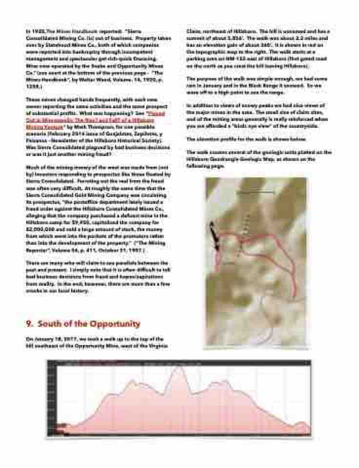
9. South of the Opportunity
On January 18, 2017, we took a walk up to the top of the hill southeast of the Opportunity Mine, west of the Virginia
Claim, northeast of Hillsboro. The hill is unnamed and has a summit of about 5,856’. The walk was about 2.2 miles and has an elevation gain of about 360’. It is shown in red on the topographic map to the right. The walk starts at a parking area on NM-152 east of Hillsboro (first gated road on the north as you crest the hill leaving Hillsboro).
The purpose of the walk was simple enough, we had some rain in January and in the Black Range it snowed. So we were off to a high point to see the range.
In addition to views of snowy peaks we had nice views of the major mines in the area. The small size of claim sites, and of the mining areas generally is really reinforced when you are afforded a “birds eye view” of the countryside.
The elevation profile for the walk is shown below.
The walk crosses several of the geologic units platted on the Hillsboro Quadrangle Geologic Map, as shown on the following page.
