
Page 29 - The Silver Fire
P. 29
THE BLACK RANGE RAG - WWW.BLACKRANGE.ORG
Fire Perimeter Using Google Earth (Con’t)
This is not an official US Forest Service Statement. Posted by The Black Range Rag.
If you have the ability to use Google Earth, click on the latest Incident Perimeters listing on the InciWeb site for the Silver Fire for the very best “picture” of what is happening with the fire. The box looks like this (see photo top right) and is located on the right hand side of the page.
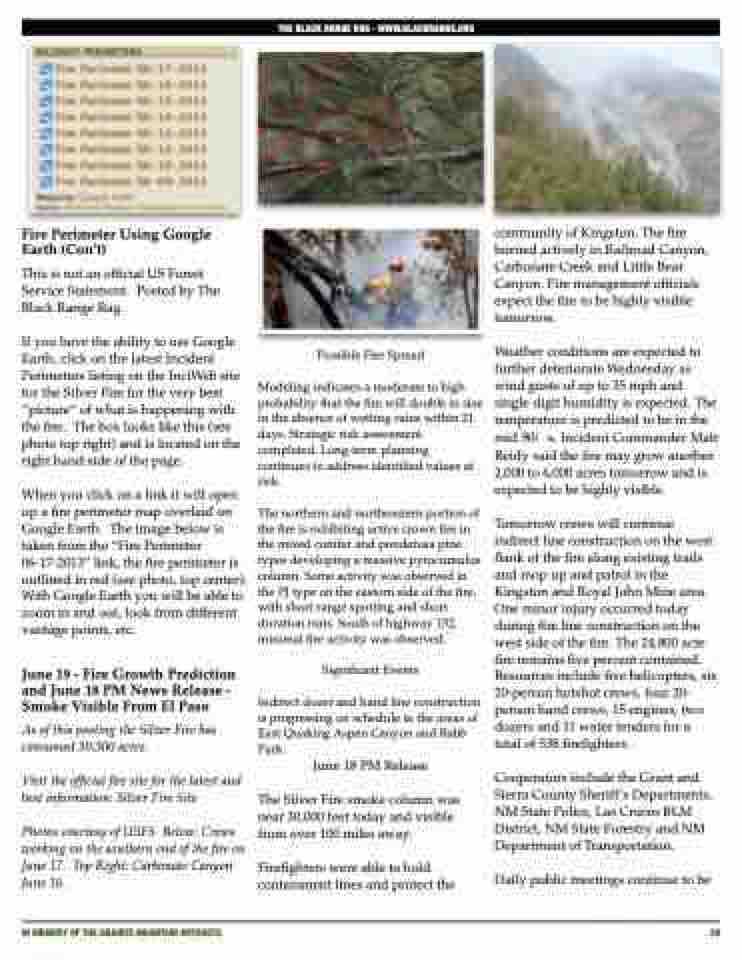
When you click on a link it will open up a fire perimeter map overlaid on Google Earth. The image below is taken from the “Fire Perimeter 06-17-2013” link, the fire perimeter is outlined in red (see photo, top center). With Google Earth you will be able to zoom in and out, look from different vantage points, etc.
June 19 - Fire Growth Prediction and June 18 PM News Release - Smoke Visible From El Paso
As of this posting the Silver Fire has consumed 30,300 acres.
Visit the official fire site for the latest and best information: Silver Fire Site
Photos courtesy of USFS Below: Crews working on the southern end of the fire on June 17. Top Right: Carbonate Canyon June 16.
Possible Fire Spread
Modeling indicates a moderate to high probability that the fire will double in size in the absence of wetting rains within 21 days. Strategic risk assessment completed. Long-term planning continues to address identified values at risk.
The northern and northeastern portion of the fire is exhibiting active crown fire in the mixed conifer and ponderosa pine types developing a massive pyrocumulus column. Some activity was observed in the PJ type on the eastern side of the fire, with short range spotting and short duration runs. South of highway 152, minimal fire activity was observed.
Significant Events
Indirect dozer and hand line construction is progressing on schedule in the areas of East Quaking Aspen Canyon and Rabb Park.
June 18 PM Release
The Silver Fire smoke column was near 30,000 feet today and visible from over 100 miles away.
Firefighters were able to hold containment lines and protect the
community of Kingston. The fire burned actively in Railroad Canyon, Carbonate Creek and Little Bear Canyon. Fire management officials expect the fire to be highly visible tomorrow.
Weather conditions are expected to further deteriorate Wednesday as wind gusts of up to 35 mph and single digit humidity is expected. The temperature is predicted to be in the mid 90í s. Incident Commander Matt Reidy said the fire may grow another 2,000 to 6,000 acres tomorrow and is expected to be highly visible.
Tomorrow crews will continue indirect line construction on the west flank of the fire along existing trails and mop up and patrol in the Kingston and Royal John Mine area. One minor injury occurred today during fire line construction on the west side of the fire. The 24,800 acre fire remains five percent contained. Resources include five helicopters, six 20-person hotshot crews, four 20- person hand crews, 15 engines, two dozers and 11 water tenders for a total of 538 firefighters.
Cooperators include the Grant and Sierra County Sheriff’s Departments, NM State Police, Las Cruces BLM District, NM State Forestry and NM Department of Transportation.
Daily public meetings continue to be
IN MEMORY OF THE GRANITE MOUNTAIN HOTSHOTS
29
