
Page 3 - Black Range Naturalist Vol. 4 No. 1
P. 3
Human Land Use of the Nutt Grasslands: A First Look
by Karl W. Laumbach
Abstract
The Nutt Grasslands, a landscape of grassy plain cut by drainages and bounded by desert, river and mountain, has been a definable geographic entity since the first human entry into the Southwest. Like grasslands everywhere with limited farming potential, the area has been a place of herds and predators, a place that people occasionally visit, often travel across, but rarely inhabit for long. Isolated by environmental factors from the encroaching shrubs of the Chihuahuan Desert, this land has endured the drying trend of the last 10,000 years from a unique vantage in the matrix of ecosystems that is southern New Mexico. This article will discuss the known archaeological and historical record of human activity in the Nutt Grasslands.
answers to those questions. When I started asking questions about the Nutt Grasslands I found out two things; 1) Everyone that I asked immediately recognized the area as being generally between Lake Valley and Nutt, New Mexico, and 2) No one that I asked had ever seen an actual definition of the boundaries nor had anyone written anything specific about the grasslands. So, in some ways I found myself on the “cutting edge” of research on environmental parameters of the Nutt Grasslands, which was certainly not my intention when I agreed to to this effort. As a result, instead of an article on human use of the Nutt Grasslands that is based on extensive research on the area, what follows is a synthesis of what I have been able to find out, most of it from email correspondence or conversations with ranchers, land managers, local historians, and scientists who were kind enough to share their knowledge with me. In that vein, I would like to thank Jim Winder, Rita Arnett and Trent Boykin of the Heritage Ranch Institute, Pam Smith, Tom Holcomb, Marcia Whitney and Tom Phillips of the Bureau of Land Management, Ann Welborn and Larena Miller of the Geronimo Springs Museum, and Dr. Walt Whitford, Senior Research Ecologist Emeritus, Jornada Experimental Range for their patience and help in understanding
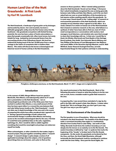
Pronghorn, Antilocapra americana, on the Nutt Grasslands, March 17, 2017. Image not in original article.
Introduction
In the summer of 2003, Margot Wilson heard me speak in Monticello, New Mexico, and subsequently asked me if I would give a presentation on the Nutt Grasslands. I am an archaeologist by profession and, of the thirty years that I have worked in southern New Mexico, a very small amount of that time has been spent either in or around the area between Nutt and Lake Valley known locally as the “Nutt Grasslands”. I could not claim any in depth knowledge of the area and in the course of preparing this article have often wondered why I agreed to do it. Having a general knowledge of both cultural and environmental change in southern New Mexico and having access to the recorded archaeological data for the area, I felt that if I could find some published data on the soils, vegetation, hydrology etc., then I would be able to cobble together something that would be meaningful and perhaps not embarrass myself too badly.
When archaeologists, or other scientists for that matter, begin a research project, they put together something called a “research design”. A research design is quite simply a review of all applicable knowledge about the subject, a list of questions about things that are not known, and a plan to find out the
the causal environment of the Nutt Grasslands. Much of the following discussion is based on what they believe to be the case and, as such, forms a testable model to guide field research in the area.
In preparing this, I was several times reminded of a sign by the grill in the little café located in Nutt, New Mexico. It states rather tersely that “this is not Burger King, you don’t get it your way. You get it our way or you don’t get it.”
The Environment of the Grasslands
The first question is one of boundaries. What area should be included in the Nutt Grasslands? The foothills of the Black Range make a convenient boundary that angles in a northeasterly direction from Cookes Peak to Lake Valley. Just north of Lake Valley, Berrenda Creek forms the northern boundary as it cuts deeply into the terrace on an easterly run to the Rio Grande. The eastern boundary is defined by “ceja” or eyebrow that marks the beginning of the “breaks” or broken land of the Rio Grande escarpment. On the south, the grasslands are bordered by first the Uvas, and then, the Good Sight Mountains, although technically the Nutt Grasslands could be considered to continue south into the Uvas Valley. Once past the Good Sights, the
2
