
Page 55 - Ranger Demo
P. 55
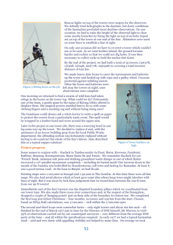
Figure 5 Sitting down on the job
Beacon lights on top of the towers were targets for the observers. We initially tried heliographs in the daytime, but dusty conditions of the harmattan precluded most daytime observations. On one occasion, we had to raise the height of the observed light to clear some nearby branches by fixing the light on top of an helio tripod set on top of the tower at one end of the line. Altimeters were used on some lines to establish a line of sight.
On only one occasion did we have to re-erect a tower which couldn’t see or be seen. As we went further inland, the ground became harder and rockier so that we could not dig holes. It was then necessary to collect rocks to hold the anchor feet down.
By the end of the project, we had built a total of 35 towers, (3@37ft, 1@50ft, 1@64ft, 20@77ft, 10@90ft) to covering a total traverse distance of 630 km.
We made heavy-duty boxes to carry the instruments and batteries up the tower and hauled up with rope and a pulley wheel. Creosote protected against nibbling insects.
Often the boxes and batteries were
left atop the towers at night, once observations were complete.
One morning we returned to find a swarm of wild bees had taken refuge in the boxes on the tower top. What could we do? Fortunately, one of the team, a gentle giant by the name of Bolong Gibbs offered to displace them. His magical powers enabled him to do so with some clicking fingers and a smoking rag and without being stung once!
The Gambians could always ask a witch doctor to write a spell on paper to protect the wearer from a particularly nasty event. The spell would be wrapped in a leather band and worn around the upper arm.
Later in the project at one tower site, there was a worrying bend in one leg some way up the tower. We decided to replace it and, with the assistance of an Acrow building prop from the local Public Works department, the offending section was fortunately replaced without having to de-construct the whole of the day’s labour. Alan described this as a typical sapper solution!
Project progress
Some names to conjure with – Kaolack to Tambacounda via Passi, Barra, Kerewan, Farafenni, Kaffrine, Bansang, Koumpentoum, Basse Santa Su and Fatoto. We remember Kaolack for our ‘French’ Bank, immense salt pans and stinking groundnut waste dumps in one of which Robin recovered a 12th parallel monument completely – including its buried mark! Our traverse down to the mouth of the Gambia was bedevilled by thunderstorms, tall trees and fasting for Ramadan. At least it was a good tarmac road. At the base in Banjul, we had floods.
Existing maps were 1:100,000 in Senegal and 1:50,000 in The Gambia. At this time these were all line maps. We also had aerial photos which at least gave some idea where large trees might interfere with lines of sight. But it was more by luck than judgement that we found lines between the 100 ft trees from our 90 ft towers!
Immediately east of the first traverse was the disputed boundary pillars which we coordinated from our tower tops. We also made three cross-river connections and, at the request of the Senegalese, dropped a couple of ‘hanging points’ just on their side of the boundary for future use. We completed the first loop just before Christmas – four months, 19 towers and 230 km from the start. Closure, based on HP45 field calculations, was 1/120,000 – well within the 1/100,000 spec.
The second and third loops went somewhat faster – only eight towers and about 160 km each – all finished by the end of March 1977 just in time for the Director of DOS himself, Mr Warren, to visit! 95% of observations carried out by our counterpart surveyors – very different from the average DOS party at the time – and all within the specifications required. In early 1977 we had a typical harmattan wind – arid and very dusty with appalling visibility not helped by many fires. On average we took
53
Figure 6 Tower builders on high
