
Page 475 - Kosovo Metohija Heritage
P. 475
pean scientific and political opinion in the 19th century. Special attention was focused on the presentation of eth- nic relations. One of the indicators is usually represented on them, but there are maps with more complex repre- sentations. Thus, for example, C. Sax, the austrian con- sul in Constantinople, identified and presented the eth- nic groups using a “combination of features”: language, confession and national consciousness. From the legend of the map it can be seen that he showed 8 major ethnic groups, 11 subgroups and three mixed categories, which are classified into three major confessions—Orthodox, Catholic and Muslim (Mohammedan) —so that the map has a total of 21 thematic units. Similarly, S. Gopčević (1889) found 13 distinct ethnic groups, while Cvijić (1913) numbered 12 of them with 23 entities, of which seven were multi-confessional ones.
Since this is about thematic maps, which in its origin represent an achievement of modern cartography from the end of the 19th and early 20th century, and cannot be found for the past centuries, for a detailed and thorough
european Maps
analysis, the historical maps of M. Pešikan, M. Macura and a. Urošević are also placed in the atlas, which are made on the basis of the Ottoman censuses from the ear- ly 16th century. The territory of Kosovo and Metohija with the surroundings is covered with several such censuses (defters, defterleri), from 1452, 1455, 1485, 1489, 1571, 1566–1574. The settlements are classified in them accord- ing to nahis, but the basic data relate to individual men, women, widows (as the heads of the families), and then the monks and unmarried adult males, i.e. to all tax pay- ers. Defterleri are transcribed from the old Turkish to Ser- bian language and are very accurate and reliable histori- cal source for the reconstruction of the ethno-demograph- ic circumstances at the beginning of the Ottoman rule in Serbia.
analyzing a unique record of personal names by set- tlements, according to linguistic affiliation, Pešikan has compiled a variety of maps showing the territorial distri- bution of population of old Serbian and old albanian type who lived in a broader regional framework of today’s
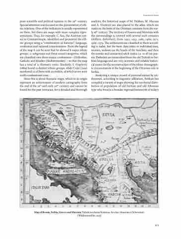
Map of Bosnia, Serbia, Greece and Slavonia (Tabula moderna Bossinae, Serviae, Graeciae et Sclavoniae) (Waldeseemüller, 1513)
473
