
Page 483 - Kosovo Metohija Heritage
P. 483
Ungarn, Siebenbűrgen, Walachei, Bulgarien, Albanien, Mace- donien, und einem Stűsk des Kirchenstaats und Kreichs Nea- pel), [1:1 1000 000] Wien: artaria.
Urošević, А. (1965). Kosovo, Belgrade: Serbian ethnograph- ic Series, vol. LXXViii, Settlements and Origin of the Popu- lation, 39. Belgrade: Serbian academy of Sciences and arts.
Hasio, i. M. (1744). Map of Hungary in the broad sense and the old or methodical complex of kingdoms: Hungary in a narrower sense, Croatia, Dalmatia, Bosnia, Serbia, Bulgar- ia, Kumanija; principality: Transylvania; despotism: Wal- lachia, Moldavia... (Hvngarie ampliori significatu et veteris vel Methodicae complexae Regna: Hungariae propriae, Cro- atiae, Dalmatiae, Bosniae, Serviae, Bulgariae, Cvmaniae, Principatum: Transsylvaniae, Despotatus: Walachiae Mol- daviae [exclusis ab eadem alienatis Galitia et Lvdomiriria] in suas Provincias ac partes divisae et quoad Imperantes ex Avstiacis, Tvrcis et Venetis distinctae ...), 1:2 500 000 [Norim- bergæ].
Herman julius, M. (1864). The European Turkey (Die Eu- ropaeische Türkey), 1:3 000 000 Leipzig – Wien.
Homanno, i. B. [1710]. The Danube Rivers (shown here as it flows from the city of Belgrade, through the Black Sea to Constantinople) the lower course, where Transylvania, Wal- lachia, Moldavia, Bulgaria, Serbia, Romania and Bessara- bia are shown with neighbouring areas (Аnubii Fluminis (hic ab urbe Belgrado per Mare Nigrum usque Constanti- nopolim defluentis exhibiti) pars infima in qua Transylva- nia, Walachia, Moldavia, Bulgaria, Servia, Romania et Bes- sarabia cum vicinis Regionibus ostenduntur), [1:2 000 000] Norimbergæ.
european Maps
Homanni, i. B. [1750]. Turkish Empire in Europe, Asia and Africa... (Imperium Turcicum in Europa, Asia et Africa, Regiones Proprias, Tributaries, Clientelares sicut et omnes ejusdem Beglirbegatus seu Præfecturas Generales exhibens), [1:12 000 000] [Norimbergæ].
Cantelli da Vignola, G. (1689). The Kingdom of Serbia, otherwise known as Rascia (Il Regno della Servia detta altri- menti Rascia), [1:470 000] Roma.
Cvijić, Ј. (1906). Political-ethnographical Sketch of Mace- donia and Old Serbia, 1:4.000.000. in: Osnove za geografiju i geologiju Makedonije i stare Srbije..., Belgrade: Serbian Roy- al academy.
Cvijić, j. (1913). Ethnographical Map of the Balkan Penin- sula (Ethnographische Karte der Balkanhalbinsel), 1:1 000 000 Gotha: justus Perthes.
Cvijić, Ј. (1918). Ethnographical Map of the Balkan Pen- insula (Carte ethnographiqe de la Péninsule des Balkans), 1:3 000 000 Paris: Librarie armand Colin.
Coronelli, M.V. (1688). The course of the rivers Drim and Bojana in Dalmatia (Corso delli fiumi Drino, e Boiana nella Dalmatia), [1:315 000] Republica di Venetia.
Cura Homannianorum Heredum (1770). Map of current Northern Greece... (Mappa Geographica Græciæ Septen- trionalis hodiernæ sive Provinciarum Macedoniæ Thessaliæ et Albaniæ, in qua ultima Provincia Habitationes sitæ Gen- tis Montenegrinæ in Comitatu Zentanensi expressæ sunt), [1:1 300 000] Norimbergæ.
Waldeseemüller, M. (1513). Modern map of Bosnia, Ser- bia, Greece and Slavonia (Тabula moderna Bossinae, Servi- ae, Graeciae et Sclavoniae). Strasbourg.
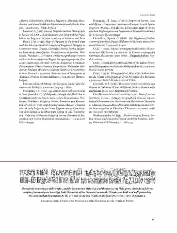
Through the benevolence of the Father, and the incarnation of the Son, and the grace of the Holy Spirit, this holy and divine temple of our most pure Sovereign Lady Theotokos, of her Presentation into the Temple, was built and wall-painted by the command and repurchase by the lord and young king Marko, in the year 6879 (=1370–1371), of Indictus 9.
inscription on the Church of the Presentation of the Theotokos into the temple, in Prizren
481
