
Page 91 - Green - Maritime Archaeology: A Technical Handbook. 2nd ed
P. 91
70 Maritime Archaeology: A Technical Handbook, Second Edition
possibility of using it on an aircraft has considerable significance. An air- craft can fly in most weather conditions and can cover very large areas very quickly. An aerial magnetic survey of the Deepwater Graveyard off Rot- tnest in Western Australia (see Figure 3.26 was recently conducted. The survey covered an area of 33km2 and was completed in just over three hours.
In early 2001 Prospero Productions, a local Western Australian film pro- duction company, approached the Department of Maritime Archaeology with the proposal to make a series of documentaries entitled the Shipwreck Detectives. One of the projects that they funded was the search for and location of ships that had been scuttled in the shipwreck graveyard off Fremantle. This project was originally initiated by McCarthy, and his research indicated that, since about 1910, vessels that were no longer useful were taken out to a site about 20 nautical miles west of Fremantle and scuttled in depths between 60 and 100 m of water. Later, after the WW II, military equipment, submarines, Lend-Least material, and commercial aircraft were also known to have been dumped there.
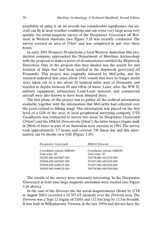
The first phase of this project was to gather all the archival information available, together with the information that McCarthy had collected over the years related to fishing snags. This information was placed on the first level of a GIS of the area. A local geophysical surveying company, UTS Geophysics, was contracted to survey two areas: he Deepwater Graveyard (24 km2) and the HMAS Derwent site (8 km2); the latter being a frigate sunk in 200 m of water as part of an Australian navy exercise in 1994. The survey took approximately 3.5 hours, and covered 338 linear km and this infor- mation can be shown on a GIS (Figure 3.29).
Deepwater Graveyard
Coordinate system AMG84 Grid zone: 50
343285.000 6453607.000 347696.000 6453607.000 347696.000 6448129.000 343285.000 6448129.000
HMAS Derwent
Coordinate system AMG84 Grid zone: 50
328758.000 6451525.000 331057.000 6451525.000 331057.000 6455260.000 328758.000 6455260.000
The results of the survey were extremely interesting. In the Deepwater Graveyard at least nine large magnetic anomalies were located (see Figure 3.26 above).
In the case of the Derwent site the aerial magnetometer (flown by UTS in August 2001) recorded a 14.787-nT anomaly over the Derwent area. The Derwent was a Type 12 frigate of 2100 t and 112.8 m long by 12.5 m breadth. It was built in Williamstown, Victoria, in the late 1950s and did not have the
