
Page 146 - Walks In The Black Range
P. 146
Speciation determinations in cactus are often contentious and uncertain. We treat the population as the new species, but . . . .
4. On the hillside above the dam there is one of the best Mimbres-era petroglyph sites in the southwestern part of the United States. (See www.earlypeople.org for photos.) At the base of the hillside, in the Ks formation, there are many grinding holes. Ks is “Sarten Sandstone - Light-gray to yellowish-gray, medium to massive- bedded, fine to medium-grained sandstone . . . crossbedding and ripple marks fairly common . . . .” (See map link.) Most of the glyphs are in the Pa formation, mostly on the sandstone. Pa is “Abo Formation . . . breccias, conglomerates, red shale, shaly limestone, and fine sandstone.” (See map link.)
5. Frying Pan Spring. A fault runs down Frying Pan Canyon, dipping to the east. To the west of the fault is the Ks formation mentioned above, to the east is Trt (tuff of the Rubio Peak Formation) capped by “Dark-gray to black basalts, basaltic andesites, andesites, and latites” and Trf, which is also part of the Rubio Peak Formation. The eroded area through the rock, photo to right, is most
Area in the wash near Frying Pan Spring, old junipers
and water-eroded rock along a fault line.
likely the fault line. A description of the route, with photos and map, from the detention dam to this spring can be found on www.blackrange.org.
6. The geologic map depicts three cross-sections. The “B” line is shown here and runs just south of this route. It is the diagonal line marked as “6” on the previous page.
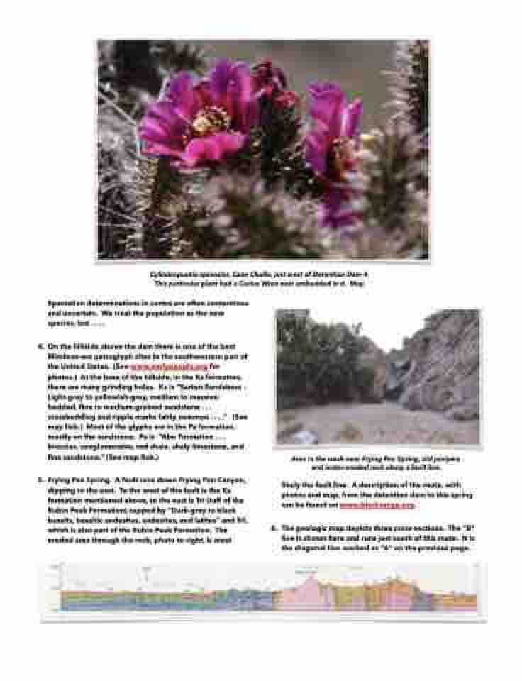
Cylindropuntia spinosior, Cane Cholla, just west of Detention Dam 4.
This particular plant had a Cactus Wren nest embedded in it. May.
