
Page 70 - Walks In The Black Range
P. 70
immediately adjacent to the framing and we were able to take video of the outside of the frame - a unique perspective.
Some residents of Hillsboro remember being lowered down the shaft, in a bucket, when they were children. Others worked in the mine during its latest incarnation. Stories about the bucket tilting and almost dumping family members down the shaft bring a shake of the head.
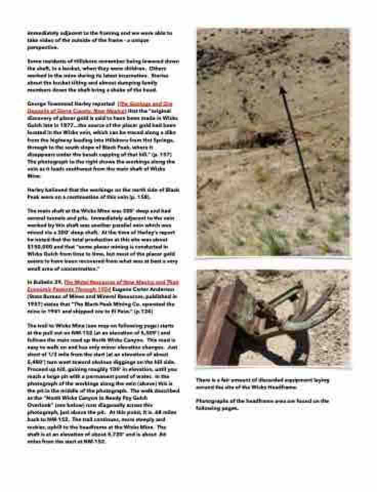
George Townsend Harley reported (The Geology and Ore Deposits of Sierra County, New Mexico) that the “original discovery of placer gold is said to have been made in Wicks Gulch late in 1877...the source of the placer gold had been located in the Wicks vein, which can be traced along a dike from the highway leading into Hillsboro from Hot Springs, through to the south slope of Black Peak, where it disappears under the basalt capping of that hill.” (p. 157) The photograph to the right shows the workings along the vein as it leads southwest from the main shaft of Wicks Mine.
Harley believed that the workings on the north side of Black Peak were on a continuation of this vein (p. 158).
The main shaft at the Wicks Mine was 300’ deep and had several tunnels and pits. Immediately adjacent to the vein worked by this shaft was another parallel vein which was mined via a 200’ deep shaft. At the time of Harley’s report he noted that the total production at this site was about $150,000 and that “some placer mining is conducted in Wicks Gulch from time to time, but most of the placer gold seems to have been recovered from what was at best a very small area of concentration.”
In Bulletin 39, The Metal Resources of New Mexico and Their Economic Features Through 1954 Eugene Carter Anderson (State Bureau of Mines and Mineral Resources, published in 1957) states that “The Black Peak Mining Co. operated the mine in 1941 and shipped ore to El Paso.” (p.124)
The trail to Wicks Mine (see map on following page) starts at the pull out on NM-152 (at an elevation of 5,509’) and follows the main road up North Wicks Canyon. This road is easy to walk on and has only minor elevation changes. Just short of 1/2 mile from the start (at an elevation of about 5,480’) turn west toward obvious diggings on the hill side. Proceed up hill, gaining roughly 100’ in elevation, until you reach a large pit with a permanent pond of water. In the photograph of the workings along the vein (above) this is the pit in the middle of the photograph. The walk described as the “North Wicks Canyon to Ready Pay Gulch
Overlook” (see below) runs diagonally across this photograph, just above the pit. At this point, it is .68 miles back to NM-152. The trail continues, more steeply and rockier, uphill to the headframe at the Wicks Mine. The shaft is at an elevation of about 5,720’ and is about .86 miles from the start at NM-152.
There is a fair amount of discarded equipment laying around the site of the Wicks Headframe.
Photographs of the headframe area are found on the following pages.
