
Page 87 - Walks In The Black Range
P. 87
20. Percha to Wicks
This walk starts in Ready Pay Gulch and follows the most northerly of the major washes on the south side of NM-152 (“Pink Canyon”) to the Percha Box and then downstream to the Wicks Canyon confluence. On the map on the following page, the walk starts at Wicks Canyon and follows the walk backward to that described above, thus the elevation profile should be read from right to left if starting at the black dot.
This walk is 3.6 miles each way. On the March 31, 2018 we started at the black dot, walked down county road B023, walked downslope to the Percha, and then walked downstream to Wicks. Our route back is as indicated above, making for a total round trip of 7.5 - 8 miles.
We found the water level in the Percha to be quite low, completely dry for substantial stretches. At the confluence of Wicks and the Percha we found that the pool of water still existed in the Wicks Slot. We first noted this development on January 12, 2018.
Butterflies were beginning to make their appearance on March 31. No snakes were observed, but several lizards were out and about. In the Percha near Wicks there were numerous Black Phoebes and Lincoln Sparrows. Killdeer were present and acting as if they were nesting. Several species of flora were beginning to flower, including two species of Mimulus.
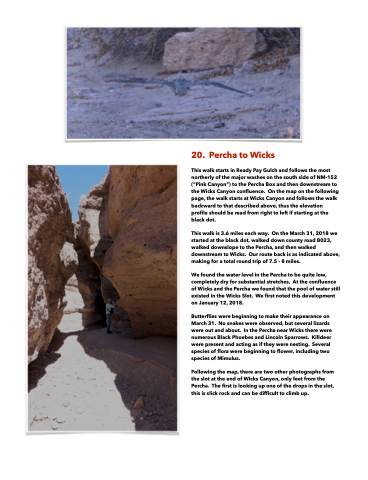
Following the map, there are two other photographs from the slot at the end of Wicks Canyon, only feet from the Percha. The first is looking up one of the drops in the slot, this is slick rock and can be difficult to climb up.
