
Page 9 - Walks In The Black Range
P. 9
2. McKnight Cabin to McKnight Mountain Summit
The drive (video) from NM-35 to the trailhead (Trail 79) near McKnight Cabin can be more difficult than the walk.
From the trailhead we walked up the trail to McKnight Mountain. The view to the west from trail 79 near McKnight Mountain is shown below.
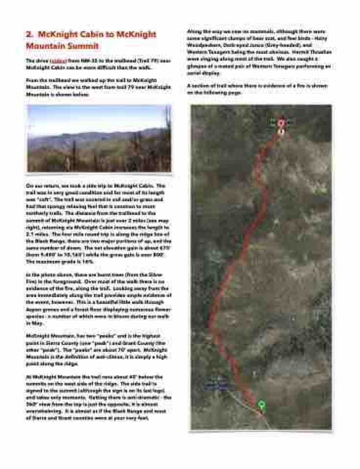
On our return, we took a side trip to McKnight Cabin. The trail was in very good condition and for most of its length was “soft”. The trail was covered in soil and/or grass and had that spongy relaxing feel that is common to more northerly trails. The distance from the trailhead to the summit of McKnight Mountain is just over 2 miles (see map right), returning via McKnight Cabin increases the length to 2.1 miles. The four mile round trip is along the ridge line of the Black Range, there are two major portions of up, and the same number of down. The net elevation gain is about 675’ (from 9,490’ to 10,165’) while the gross gain is over 800’. The maximum grade is 16%.
In the photo above, there are burnt trees (from the Silver Fire) in the foreground. Over most of the walk there is no evidence of the fire, along the trail. Looking away from the area immediately along the trail provides ample evidence of the event, however. This is a beautiful little walk through Aspen groves and a forest floor displaying numerous flower species - a number of which were in bloom during our walk in May.
McKnight Mountain, has two “peaks” and is the highest point in Sierra County (one “peak”) and Grant County (the other “peak”). The “peaks” are about 70’ apart. McKnight Mountain is the definition of anti-climax, it is simply a high point along the ridge.
At McKnight Mountain the trail runs about 40’ below the summits on the west side of the ridge. The side trail is signed to the summit (although the sign is on its last legs) and takes only moments. Getting there is anti-dramatic - the 360° view from the top is just the opposite, it is almost overwhelming. It is almost as if the Black Range and most of Sierra and Grant counties were at your very feet.
Along the way we saw no mammals, although there were some significant clumps of bear scat, and few birds - Hairy Woodpeckers, Dark-eyed Junco (Grey-headed), and Western Tanagers being the most obvious. Hermit Thrushes were singing along most of the trail. We also caught a glimpse of a mated pair of Western Tanagers performing an aerial display.
A section of trail where there is evidence of a fire is shown on the following page.
