
Page 36 - Vol 2 Walks In The Black Range Eastern Foothills South
P. 36
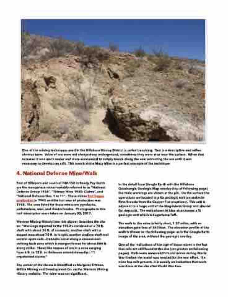
  One of the mining techniques used in the Hillsboro Mining District is called trenching. That is a descriptive and rather obvious term. Veins of ore were not always deep underground, sometimes they were at or near the surface. When that occurred it was much easier and more economical to simply trench along the vein extracting the ore until it was necessary to develop an adit. This trench at the Macy Mine is a perfect example of the technique.
4. National Defense Mine/Walk
East of Hillsboro and south of NM-152 in Ready Pay Gulch are the manganese mines variably referred to as “National Defense Group 1958”, “Tittman Mine 1950: Claims”, and “National Defense Nos. 1 to 11". These mines first began production in 1945 and the last year of production was 1958. The ores listed for these mines are pyrolusite, psilomelane, wad, and rhodochrosite. Photographs in this trail description were taken on January 23, 2017.


In the detail from Google Earth with the Hillsboro Quadrangle Geologic Map overlay (top of following page) the main workings are shown at the pin. On the surface the operations are located in a Ka geologic unit (an andesite flow/breccia from the Copper Flat eruptions). This unit is adjacent to a large unit of the Magdalena Group and alluvial fan deposits. The walk shown in blue also crosses a Ts geologic unit which is Sugarlump Tuff.
The walk to the mine is fairly short, 1.37 miles, with an elevation gain/loss of 360 feet. The elevation profile of the walk is shown on the following page, as is the Google Earth image of the area, without the geologic overlay.
One of the indications of the age of these mines is the fact that rails are still found at the site (see photos on following pages). Rails were removed from old mines during World War II when the metal was needed for the war effort. If a mine has rails present, it is usually an indication that work was done at the site after World War Two.
  Western Mining History (see link above) describes the site as: “Workings reported in the 1950‘s consisted of a 70 ft. shaft with about 30 ft. of crosscuts, another shaft with a stoped area about 70 ft. in length, another shallow shaft and several open-cuts...Deposits occur along a sinuous east- striking fault zone which is manganiferous for about 800 ft. along strike. Sheet like masses of ore in a zone ranging from 6 ft. to 12 ft. in thickness extend downdip...11 unpatented claims.”
The owner of the claims is identified as Margaret Tittman, Millite Mining and Development Co. on the Western Mining History website. The mine was not significant.
