
Page 56 - Vol 2 Walks In The Black Range Eastern Foothills South
P. 56
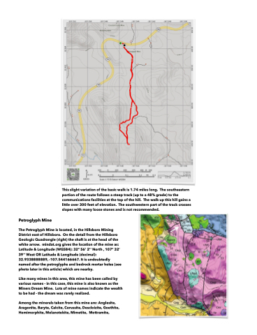
  This slight variation of the basic walk is 1.74 miles long. The southeastern portion of the route follows a steep track (up to a 48% grade) to the communications facilities at the top of the hill. The walk up this hill gains a little over 300 feet of elevation. The southwestern part of the track crosses slopes with many loose stones and is not recommended.
 Petroglyph Mine
The Petroglyph Mine is located, in the Hillsboro Mining District east of Hillsboro. On the detail from the Hillsboro Geologic Quadrangle (right) the shaft is at the head of the white arrow. mindat.org gives the location of the mine as: Latitude & Longitude (WGS84): 32° 56' 2'' North , 107° 32' 39'' West OR Latitude & Longitude (decimal): 32.9338888889, -107.544166667. It is undoubtedly named after the petroglyphs and bedrock mortar holes (see photo later in this article) which are nearby.
Like many mines in this area, this mine has been called by various names - in this case, this mine is also known as the Miners Dream Mine. Lots of mine names indicate the wealth to be had - the dream was rarely realized.
Among the minerals taken from this mine are: Anglesite, Aragonite, Baryte, Calcite, Cerussite, Descloizite, Goethite, Hemimorphite, Melanotekite, Mimetite, Mottramite,
