
Page 16 - Volume 3 - Walks In The Black Range
P. 16
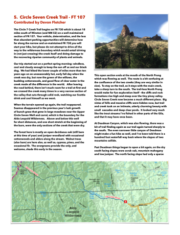
  5. Circle Seven Creek Trail - FT 107
 Contributed by Devon Fletcher
The Circle 7 Creek Trail begins on FR 730 which is about 18 miles south of Winston (and NM 52) on a well maintained section of FR 157. Your vehicle, determination, and the less than abundant parking opportunities will determine how far along the narrow and un-maintained FR 730 you will start your hike, but please do not attempt to drive all the way to the wilderness boundary which would entail driving in (not just crossing) the creek itself and doing damage to the recovering riparian community of plants and animals.
Our trip started out on a perfect spring morning: windless, cool and cloudy enough to keep the sun off us and our black dog. We had hiked the lower couple of miles more than ten years ago on an unseasonably hot, early fall day when the creek was dry, but now the green of the willows, the budding cottonwoods, and good flow of clear water in the creek made all the difference in the world. After leaving the road behind, there isn't much room for a trail at first and we crossed the creek many times in a very narrow section of the valley that cuts through solid rock, watching our Scottie drink and cool himself as we went.
When the terrain opened up again, the trail reappeared. Seamus disappeared in the previous year’s lush growth
of bunch grass that grew in large meadows near the Upper Circle Seven Well and corral, which is the boundary for the Aldo Leopold Wilderness. Above and below this well
for short distances, and one short stretch at the beginning of the burn, were the only sections of the creek that were dry.
The forest here is mostly an open deciduous oak (still bare at this time of year) and juniper woodland with occasional cottonwoods and alders along the stream. Walnut trees (also bare) are here also, as well as, cypress, pines, and the occasional fir. The evergreens provide the only, and welcome, shade this early in the season.

This open section ends at the mouth of the North Prong which was flowing as well. The route is a bit confusing at the confluence of the two creeks (they are very similar in size). To stay on the trail, as it stays with the main creek, take a sharp turn to the south. The trail-less North Prong would make for fun exploration itself - the cliffs and rock formations rise high and steep over the tiny piney valley. Circle Seven Creek now became a much different place. Big vistas of hills and massive cliffs were hidden now, but trail and creek took on an intimate, utterly charming beauty with small cascades and deep clear pools. It looked very much like the trout streams I've fished in other parts of the Gila, and that it may have once been.
At Deadman Canyon, which was also flowing, there was a bit of trail finding again as our trail again turned sharply to the south. The even narrower little canyon of Deadman might make a fun hike as well, and I've been told there is a hundred foot waterfall way back where the slopes of two mountains collide.
Past Deadman things began to open a bit again, on the dry south facing slopes were scrub oak, mountain mahogany and low juniper. The north facing slope had only a sparse
