
Page 50 - Volume 3 - Walks In The Black Range
P. 50
This trail starts at the quarry next to Railroad Canyon Campground (just off of NM-152) and proceeds up the mountain valley to the Holden Prong Saddle on the Black Range Crest Trail. Route finding on the trail is straight forward, although there are two trail junctions along the way. Starting out at the trailhead, Forest Trail 129 follows the stream bed north, mostly level, with insignificant elevation gain/loss. At about 1.5 miles, 129 (the Gallinas Canyon Trail) leads to the left. This junction is the start of Forest Trail 128. Keep straight in the stream bottom on trail 128 (on the ground it will feel like you remain on the main trail). Roughly a mile farther along the trail there is a well marked “Y” junction. The trail to your right leads to the Black Range Crest trail (no. 79 - East Railroad Canyon) south of Hillsboro Peak. The trail to Holden Prong Saddle is to the left. The trail has been relatively level to this point, from here most of the elevation gain on the trail occurs. The trail has a net elevation gain of about 1700 feet, almost half of which occurs in the last mile and a half.
individual, the individual trunks are supported by a vast underground root network. Many of the individual trunks did not survive the fire, many are now standing dead trunks. Many others did survive the fire and numerous suckers are growing within the grove area. A photograph from this section is shown above (October 17, 2017).
At that time the trail was in good shape and always obvious. There is a fair amount of grass and vegetation growing on/ near the trail but the trail was not obscured.
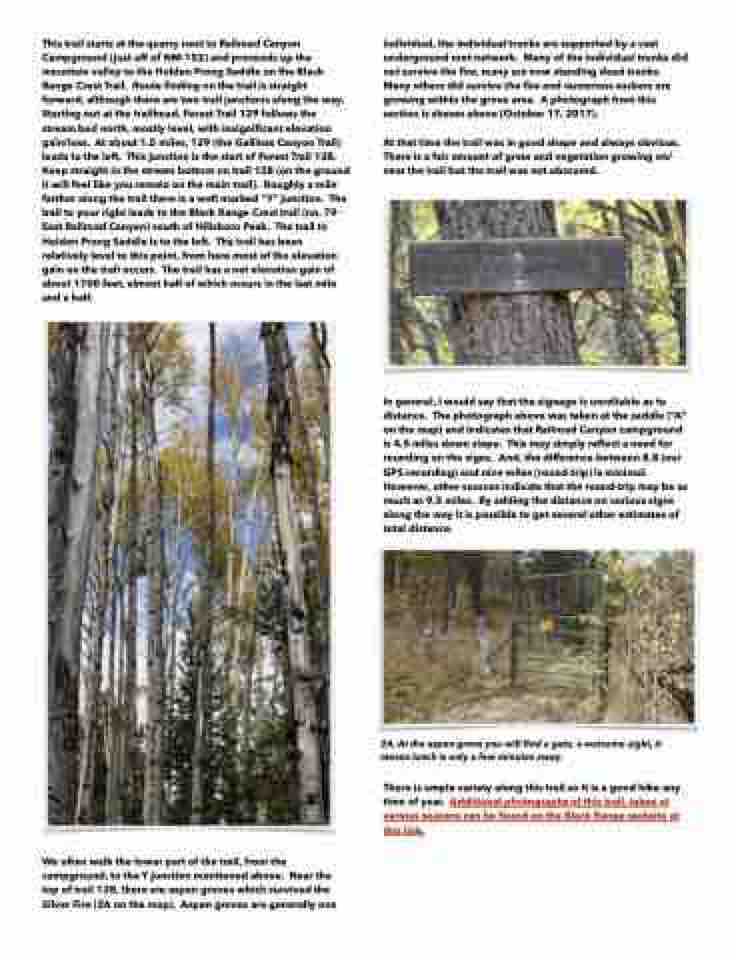
In general, I would say that the signage is unreliable as to distance. The photograph above was taken at the saddle (“A” on the map) and indicates that Railroad Canyon campground is 4.5 miles down slope. This may simply reflect a need for rounding on the signs. And, the difference between 8.8 (our GPS recording) and nine miles (round-trip) is minimal. However, other sources indicate that the round-trip may be as much as 9.5 miles. By adding the distance on various signs along the way it is possible to get several other estimates of total distance.
2A. At the aspen grove you will find a gate, a welcome sight, it means lunch is only a few minutes away.
There is ample variety along this trail so it is a good hike any time of year. Additional photographs of this trail, taken at various seasons can be found on the Black Range website at this link.
We often walk the lower part of the trail, from the campground, to the Y junction mentioned above. Near the top of trail 128, there are aspen groves which survived the Silver Fire (2A on the map). Aspen groves are generally one
