
Page 95 - Volume 3 - Walks In The Black Range
P. 95
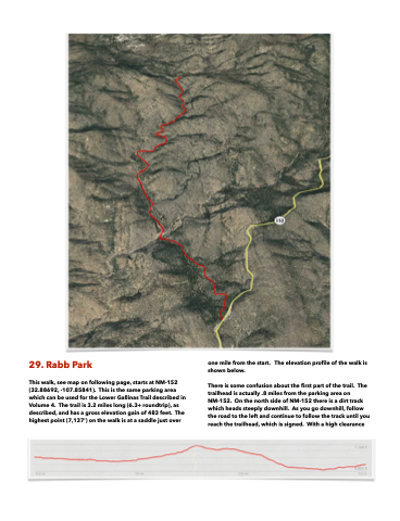
 29. Rabb Park
This walk, see map on following page, starts at NM-152 (32.88692, -107.85841). This is the same parking area which can be used for the Lower Gallinas Trail described in Volume 4. The trail is 3.2 miles long (6.3+ roundtrip), as described, and has a gross elevation gain of 483 feet. The highest point (7,137’) on the walk is at a saddle just over
one mile from the start. The elevation profile of the walk is shown below.
There is some confusion about the first part of the trail. The trailhead is actually .8 miles from the parking area on NM-152. On the north side of NM-152 there is a dirt track which heads steeply downhill. As you go downhill, follow the road to the left and continue to follow the track until you reach the trailhead, which is signed. With a high clearance
