
Page 24 - Early Naturalists of the Black Range
P. 24
Josiah Gregg
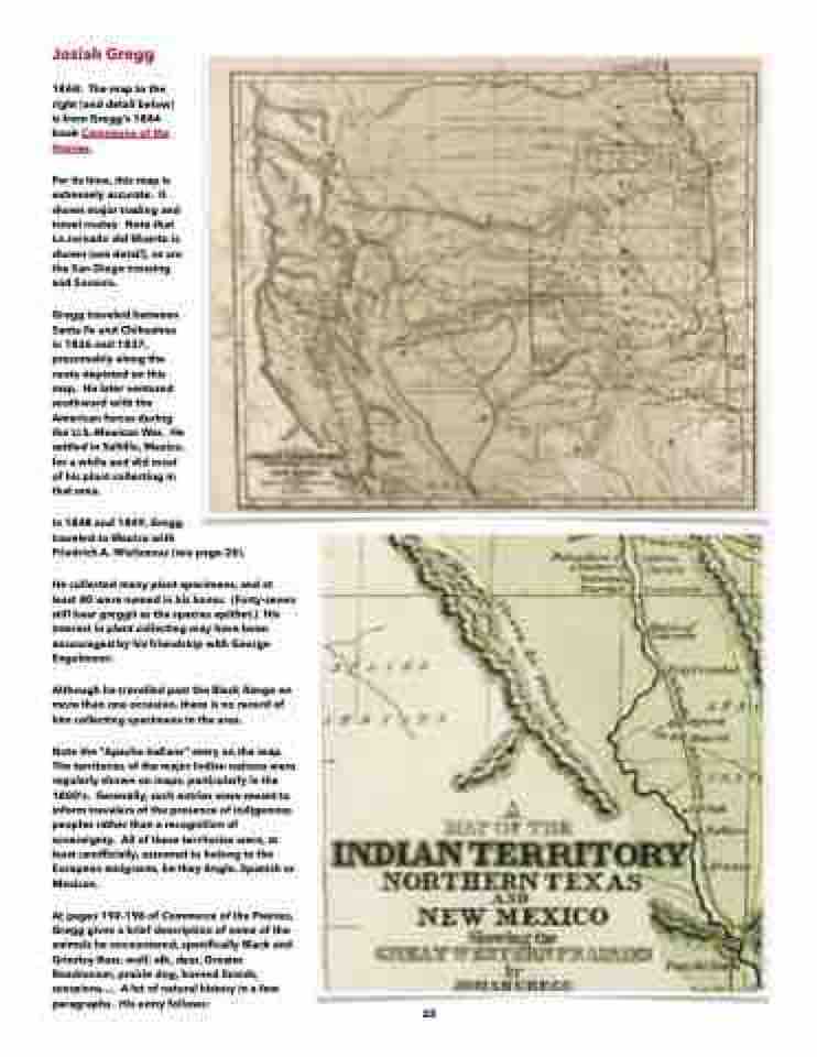
1844: The map to the right (and detail below) is from Gregg’s 1844 book Commerce of the Prairies.
For its time, this map is extremely accurate. It shows major trading and travel routes. Note that La Jornado del Muerto is shown (see detail), as are the San Diego crossing and Socorro.
Gregg traveled between Santa Fe and Chihuahua in 1836 and 1837, presumably along the route depicted on this map. He later ventured southward with the American forces during the U.S.-Mexican War. He settled in Saltillo, Mexico, for a while and did most of his plant collecting in that area.
In 1848 and 1849, Gregg
traveled to Mexico with
Friedrich A. Wislizenus (see page 26).
He collected many plant specimens, and at least 80 were named in his honor. (Forty-seven still bear greggii as the species epithet.) His interest in plant collecting may have been encouraged by his friendship with George Engelmann.
Although he travelled past the Black Range on more than one occasion, there is no record of him collecting specimens in the area.
Note the “Apache Indians” entry on the map. The territories of the major Indian nations were regularly shown on maps, particularly in the 1800’s. Generally, such entries were meant to inform travelers of the presence of indigenous peoples rather than a recognition of sovereignty. All of these territories were, at least unofficially, assumed to belong to the European emigrants, be they Anglo, Spanish or Mexican.
At pages 192-196 of Commerce of the Prairies, Gregg gives a brief description of some of the animals he encountered, specifically Black and Grizzley Bear, wolf, elk, deer, Greater Roadrunner, prairie dog, horned lizards, scorpions.... A lot of natural history in a few paragraphs. His entry follows:
23
