
Page 115 - Vol. 1 Walks In The Black Range - 2nd Edition
P. 115
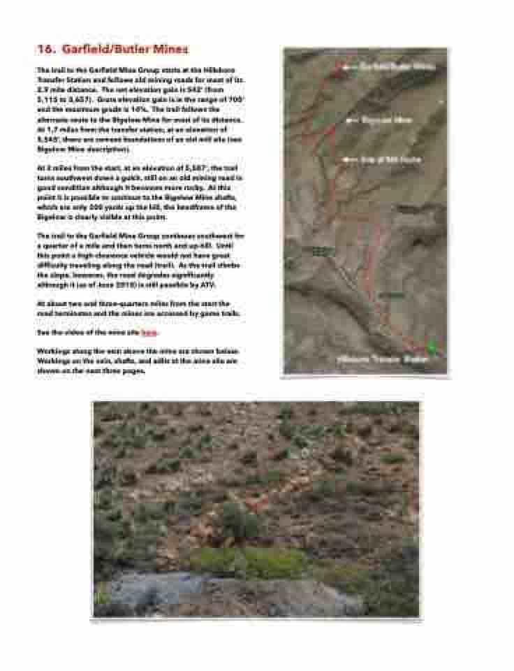
 16. Garfield/Butler Mines
The trail to the Garfield Mine Group starts at the Hillsboro Transfer Station and follows old mining roads for most of its 2.9 mile distance. The net elevation gain is 542‘ (from 5,115 to 5,657). Gross elevation gain is in the range of 700‘ and the maximum grade is 14%. The trail follows the alternate route to the Bigelow Mine for most of its distance. At 1.7 miles from the transfer station, at an elevation of 5,545’, there are cement foundations of an old mill site (see Bigelow Mine description).
At 2 miles from the start, at an elevation of 5,587’, the trail turns southwest down a gulch, still on an old mining road in good condition although it becomes more rocky. At this point it is possible to continue to the Bigelow Mine shafts, which are only 200 yards up the hill, the headframe of the Bigelow is clearly visible at this point.
The trail to the Garfield Mine Group continues southwest for a quarter of a mile and then turns north and up-hill. Until this point a high-clearance vehicle would not have great difficulty traveling along the road (trail). As the trail climbs the slope, however, the road degrades significantly although it (as of June 2015) is still passible by ATV.
At about two and three-quarters miles from the start the road terminates and the mines are accessed by game trails.
See the video of the mine site here.
Workings along the vein above the mine are shown below. Workings on the vein, shafts, and adits at the mine site are shown on the next three pages.
