
Page 4 - Vol. 1 Walks In The Black Range - 2nd Edition
P. 4
12. Rattlesnake Mine Trail No. 2
This mine site may be accessed from three major routes. The description at this link describes the walk which begins at the Hillsboro Transfer Station on the west side of the mine.
13. Bonanza Mine Trail
A round-trip distance of 3.7 miles from the Hillsboro Transfer Station to the mine entrance. Elevation gain of about 360 feet.
14. Bigelow Mine Trail
This trail starts at the Hillsboro Transfer station n.e. of Hillsboro and follows an old mining/ranch road to the site of the Bigelow Mine. The walk has two major variations, one of which is 2.1 miles (from the Transfer Station to the Mine) and the other is 2.3 miles. Also: See Road Video.
15. Jackpot Mine
Across the canyon from the Bigelow Mine, this site is accessed by an old mining road.
16. Garfield-Butler Mine Trail
A walk of 2.9 miles from the Hillsboro Transfer Station to the mine entrance.
17. Empire Peak Trail
From Bigelow Mine to the saddle and Empire Peak above.
OTHER MINING LOCATIONS
18. El Oro Mine and Andrews
There are multiple walk opportunities available at the old townsite of Andrews, northeast of Hillsboro. The description here is of the townsite itself. A road video of the trip from NM-152 to Andrews is available at this link.
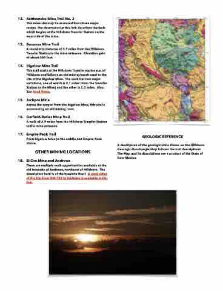
GEOLOGIC REFERENCE
A description of the geologic units shown on the Hillsboro Geologic Quadrangle Map follows the trail descriptions. The Map and its descriptions are a product of the State of New Mexico.
