
Page 37 - Black Range Naturalist Vol. 4 No. 1
P. 37
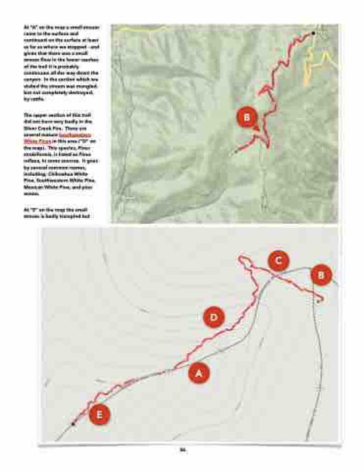
  At “A” on the map a small stream came to the surface and continued on the surface at least as far as where we stopped - and given that there was a small stream flow in the lower reaches of the trail it is probably continuous all the way down the canyon. In the section which we visited the stream was mangled, but not completely destroyed, by cattle.
The upper section of this trail did not burn very badly in the Silver Creek Fire. There are several mature Southwestern White Pines in this area (“D” on the map). This species, Pinus strobiformis, is listed as Pinus reflexa, in some sources. It goes by several common names, including; Chihuahua White Pine, Southwestern White Pine, Mexican White Pine, and pino enano.
At “E” on the map the small stream is badly trampled but
B
      D
A
C
B
    E
36
