
Page 105 - Walks In The Black Range, Vol. 4
P. 105
17. McGee Canyon
Contributed by Devon Fletcher
To reach McGee Canyon, drive
north from NM-26 on the Greenleaf
Mine Road (a well maintained
county road). We drove north until
we reached a very slow road just
past Starvation Draw Dam # 2,
stopping at a point about a mile
directly west of McGee Canyon. It
is possible to halve that distance by
using a different low maintenance
road that also heads northeast from
a point close to the east end of the
Starvation Draw Dam # 1.
McGee Canyon is a rocky little
defile on BLM land, that incises
itself deeply into the ridge that is
the western edge of Frying Pan
Canyon. It heads west for less than
a mile before joining the much
larger arroyo that is dammed by
Starvation Draw Dam # 3. Coming
at it from the west we crossed
creosote flats, climbed a few mounds, eased in and out a couple of large arroyos, and stepped over another road as well. It is not on maps as far as I can tell. Where it starts, I can't say. All the while we kept a line toward some cliffs that we took to be the entrance to the little canyon. At the mouth was a large juniper, and there were more further up the stream course as well. There was also the high dried grasses of last summer, and much scrub oak, which were further indicators that water lingers in this canyon and that it may even have seasonal springs. We all speculated that in times past perhaps China Draw and Starvation Draw
themselves had, if not perennial flow, then extended seasons of surface flow. Which may explain why this place was attractive to ancient peoples.
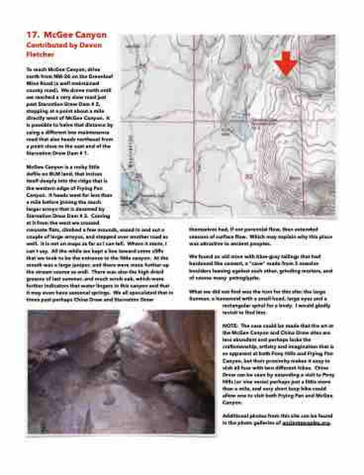
We found an old mine with blue-gray tailings that had hardened like cement, a "cave" made from 3 massive boulders leaning against each other, grinding mortars, and of course many petroglyphs.
What we did not find was the icon for this site: the large Sunman, a humanoid with a small head, large eyes and a
rectangular spiral for a body. I would gladly revisit to find him.
NOTE: The case could be made that the art at the McGee Canyon and China Draw sites are less abundant and perhaps lacks the craftsmanship, artistry and imagination that is so apparent at both Pony Hills and Frying Pan Canyon, but their proximity makes it easy to visit all four with two different hikes. China Draw can be seen by extending a visit to Pony Hills (or vice versa) perhaps just a little more than a mile, and very short loop hike could allow one to visit both Frying Pan and McGee Canyon.
Additional photos from this site can be found in the photo galleries of ancientpeoples.org.
