
Page 98 - Walks In The Black Range, Vol. 4
P. 98
15. Sadler Mine
The Sadler Mine (Saddler Mine, in some sources) is located at the southeastern end of the Pony Hills (Fluorite Ridge), northeast of Deming. At about MP 6, turn north off of
NM 26, on to Greenleaf Road (Green Leaf Road and/or County Road 16, or A016 in some sources). When you reach the Pony Hills Ridge, which are the hills on the left of the road as you approach from the south, there will be several
structures on your left. These structures were part of the Greenleaf Mine complex. The road to the Saddler Mine is more or less obvious, high clearance is recommended.
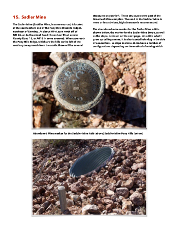
The abandoned mine marker for the Sadler Mine adit is shown below, the marker for the Sadler Mine Stope, as well as the stope, is shown on the next page. An adit is what I grew up calling a mine, it is a horizontal hole dug in the side of a mountain. A stope is a hole, it can have a number of configurations depending on the method of mining which
Abandoned Mine marker for the Saddler Mine Adit (above) Saddler Mine Pony Hills (below)
