
Page 58 - Demo Faces
P. 58
58
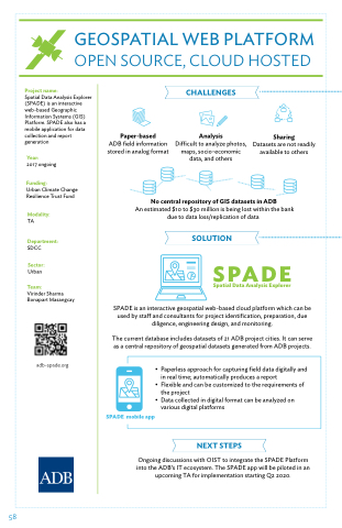
GEOSPATIAL WEB PLATFORM
OPEN SOURCE, CLOUD HOSTED
Project name:
Spatial Data Analysis Explorer (SPADE) is an interactive web-based Geographic Information Systems (GIS) Platform. SPADE also has a mobile application for data collection and report generation
Year:
2017 ongoing
Funding:
Urban Climate Change Resilience Trust Fund
Modality:
TA
Department:
SDCC
Sector:
Urban
Team:
Virinder Sharma Bonapart Masangcay
adb-spade.org
Paper-based
ADB field information stored in analog format
CHALLENGES:
Analysis
Di cult to analyze photos, maps, socio-economic data, and others
Sharing
Datasets are not readily available to others
No central repository of GIS datasets in ADB
An estimated $10 to $30 million is being lost within the bank due to data loss/replication of data
SOLUTION
SPADE
Spatial Data Analysis Explorer
SPADE is an interactive geospatial web-based cloud platform which can be used by sta and consultants for project identification, preparation, due diligence, engineering design, and monitoring.
The current database includes datasets of 21 ADB project cities. It can serve as a central repository of geospatial datasets generated from ADB projects.
SPADE mobile app
• Paperless approach for capturing field data digitally and in real time; automatically produces a report
• Flexible and can be customized to the requirements of the project
• Data collected in digital format can be analyzed on various digital platforms
NEXT STEPS
Ongoing discussions with OIST to integrate the SPADE Platform into the ADB’s IT ecosystem. The SPADE app will be piloted in an upcoming TA for implementation starting Q2 2020.
