
Page 216 - Green - Maritime Archaeology: A Technical Handbook. 2nd ed
P. 216
Chapter 6: Photogrammetric Techniques 195
sary to have precise targets to be able to plot objects. Thus it is reasonably easy to follow features such as ship structures or to plot contours.
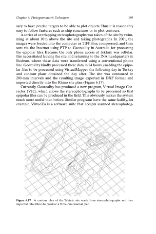
A series of overlapping stereophotographs was taken of the site by swim- ming at about 10m above the site and taking photographs. In 2001, the images were loaded into the computer as TIFF files, compressed, and then sent via the Internet using FTP to Georeality in Australia for processing the epipolar files. Because the only phone access at Tektash was cellular, this necessitated leaving the site and returning to the INA headquarters in Bodrum, where these data were transferred using a conventional phone line. Georeality kindly processed these data in 24 hours, enabling the epipo- lar files to be processed using VirtualMapper the following day in Turkey and contour plans obtained the day after. The site was contoured in 200-mm intervals and the resulting image exported in DXF format and imported directly into the Rhino site plan (Figure 6.17).
Currently, Georeality has produced a new program, Virtual Image Cor- rector (VIC), which allows the stereophotographs to be processed so that epipolar files can be produced in the field. This obviously makes the system much more useful than before. Similar programs have the same facility, for example, VirtuoZo is a software suite that accepts scanned stereophotog-
Figure 6.17 A contour plan of the Tektash site made from stereophotographs and then imported into Rhino to produce a three-dimensional plan.
