
Page 232 - Green - Maritime Archaeology: A Technical Handbook. 2nd ed
P. 232
Chapter 7: Site Plans and Geographical Information Systems 211
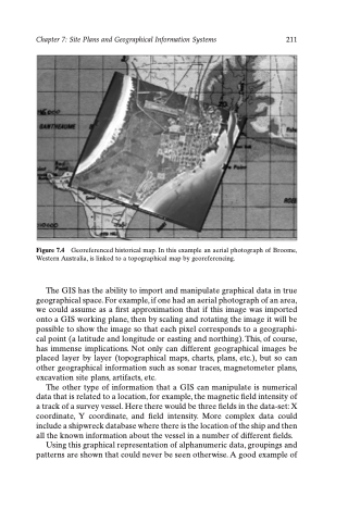
Figure 7.4 Georeferenced historical map. In this example an aerial photograph of Broome, Western Australia, is linked to a topographical map by georeferencing.
The GIS has the ability to import and manipulate graphical data in true geographical space. For example, if one had an aerial photograph of an area, we could assume as a first approximation that if this image was imported onto a GIS working plane, then by scaling and rotating the image it will be possible to show the image so that each pixel corresponds to a geographi- cal point (a latitude and longitude or easting and northing). This, of course, has immense implications. Not only can different geographical images be placed layer by layer (topographical maps, charts, plans, etc.), but so can other geographical information such as sonar traces, magnetometer plans, excavation site plans, artifacts, etc.
The other type of information that a GIS can manipulate is numerical data that is related to a location, for example, the magnetic field intensity of a track of a survey vessel. Here there would be three fields in the data-set: X coordinate, Y coordinate, and field intensity. More complex data could include a shipwreck database where there is the location of the ship and then all the known information about the vessel in a number of different fields.
Using this graphical representation of alphanumeric data, groupings and patterns are shown that could never be seen otherwise. A good example of
