
Page 75 - Green - Maritime Archaeology: A Technical Handbook. 2nd ed
P. 75
54 Maritime Archaeology: A Technical Handbook, Second Edition
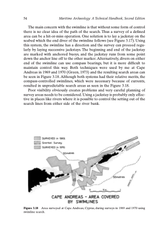
The main concern with the swimline is that without some form of control there is no clear idea of the path of the search. Thus a survey of a defined area can be a hit-or-miss operation. One solution is to lay a jackstay on the seabed which the end diver of the swimline follows (see Figure 3.17). Using this system, the swimline has a direction and the survey can proceed regu- larly by laying successive jackstays. The beginning and end of the jackstay are marked with anchored buoys, and the jackstay runs from some point down the anchor line off to the other marker. Alternatively, divers on either end of the swimline can use compass bearings, but it is more difficult to maintain control this way. Both techniques were used by me at Cape Andreas in 1969 and 1970 (Green, 1973) and the resulting search areas can be seen in Figure 3.18. Although both systems had their relative merits, the compass-controlled swimlines, which were necessary because of currents, resulted in unpredictable search areas as seen in the Figure 3.18.
Poor visibility obviously creates problems and very careful planning of survey areas needs to be considered. Using a jackstay is probably only effec- tive in places like rivers where it is possible to control the setting out of the search lines from either side of the river bank.
Figure 3.18 Area surveyed at Cape Andreas, Cyprus, during surveys in 1969 and 1970 using swimline search.
