
Page 164 - Kennemerland VOC ship, 1664 - Published Reports
P. 164
NAUTICAL ARCHAEOLOGY,20.2
Figure 13.
Navigational dividers, 87-K-I, before con- servation. Heavily eroded and missing the wrought iron points.
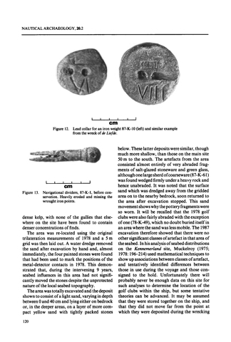
Figure 12.
wcm
-
Lead collar for an iron weight 87-K-10 (left) and similar example from the wreck o f de LieJde.
below.Theselatterdepositsweresimilar,though much more shallow, than those on the main site 50m to the south. The artefacts from the area consisted almost entirely of very abraded frag- ments of salt-glazed stoneware and green glass, althoughonelargesherdofcoarseware(87-K-61) was found wedged firmly under a heavy rock and hence unabraded. It was noted that the surface sand which was dredged away from the gridded area on to the nearby bedrock, soon returned to the area after excavation stopped. This sand movementshowswhythepottery fragmentswere so worn. It will be recalled that the 1978 golf clubs were also fairly abraded with the exception of one (78-K-49),which no doubt buried itself in anareawherethesandwaslessmobile.The 1987 excavation therefore showed that there were no other significantclassesof artefact in that area of theseabed.Inhisanalysisofseabeddistributions on the Kennemerland site, Muckelroy (1975; 1978: 196-214) used mathematicaltechniquesto showupassociationsbetweenclassesofartefact,
and tentatively identified differences between those in use during the voyage and those con- signed to the hold. Unfortunately there will probably never be enough data on this site for such analyses to determine the location of the golf clubs within the ship, but some tentative theories can be advanced. It may be assumed that they were stored together on the ship, and that they did not move far from the point at which they were deposited during the wrecking
cm
dense kelp, with none of the gullies that else- where on the site have been found to contain denser concentrations of finds.
The area was re-located using the original trilateration measurements of 1978 and a 5 m gridwasthenlaidout.Awaterdredgeremoved the sand after excavation by hand and, almost immediately,thefourpaintedstoneswerefound that had been used to mark the positions of the metal-detector contacts in 1978. This demon- strated that, during the intervening 9 years, seabed influences in this area had not signifi- cantly moved the stones despite the unprotected nature of the local seabed topography.
The area was totally excavated and the deposit shown to consist of a light sand, varying in depth between0and40cmandlyingeitheronbedrock or, in the deeper areas, on a layer of more com- pact yellow sand with tightly packed stones
120
