Page 480 - The ROV Manual - A User Guide for Remotely Operated Vehicles 2nd edition
P. 480
  474 CHAPTER 17 Navigational Sensors
ship. If the ship has a known position (e.g., from a GPS), it is easy to deduce the absolute position of the ROV or tow body (or any other client, for that matter).
The way a USBL system calculates the position of a client is to first estimate the distance by sim- ply using the signal’s travel time from the client to the USBL array. Knowledge of the speed of sound (rate) through the water column, along with the known propagation time, will give the distance to the client. Analyzing the phase delay across the USBL array will give the angle at which the signal was received. With that information, the position of the client relative to the ship can be derived.
The main disadvantage of the USBL system is the position error. The position error grows pro- portionally with the slant range. Although USBL systems are improving, a high-grade USBL sys- tem would have errors in the area of 0.1% of slant range. This means that if the client is operating at a depth of 10,000 ft (3000 m), the position will only be good to 10 ft (3 m) for zero slant range, with the error scaling as the slant distance increases. Less accurate systems would easily have up to 65100 ft (2030 m) of error (without slant range) at a 10,000 ft (3000 m) depth. One of the advantages, as opposed to the LBL array, is that it is very easy to move the USBL from site to site.
17.12 Combined instruments
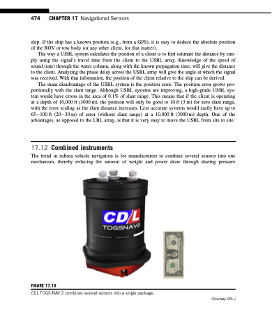
The trend in subsea vehicle navigation is for manufacturers to combine several sensors into one
mechanism, thereby reducing the amount of weight and power draw through sharing pressure
  FIGURE 17.19
CDL TOGS-NAV 2 combines several sensors into a single package.
 (Courtesy CDL.)


