
Page 43 - Discovery Guide
P. 43
How the use of 21st Century technology harnesses precision-mapping and geolocation techniques to restore the Forest of Bowland’s precious peatlands
Millions of pounds are being invested in peat restoration across England’s northern uplands, with conservationists deploying the very latest technology to maximise success rates in the Forest of Bowland’s precious peatlands.
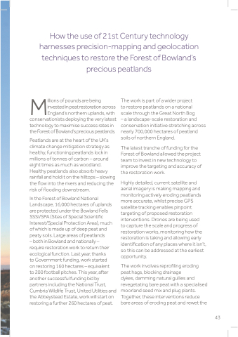
Peatlands are at the heart of the UK’s climate change mitigation strategy as healthy, functioning peatlands lock in millions of tonnes of carbon – around eight times as much as woodland. Healthy peatlands also absorb heavy rainfall and hold it on the hilltops – slowing the flow into the rivers and reducing the risk of flooding downstream.
In the Forest of Bowland National Landscape, 16,000 hectares of uplands are protected under the Bowland Fells SSSI/SPA (Sites of Special Scientific Interest/Special Protection Area), much of which is made up of deep peat and peaty soils. Large areas of peatlands
– both in Bowland and nationally –
require restoration work to return their ecological function. Last year, thanks
to Government funding, work started
on restoring 160 hectares – equivalent
to 200 football pitches. This year, after another successful funding bid by partners including the National Trust, Cumbria Wildlife Trust, United Utilities and the Abbeystead Estate, work will start on restoring a further 260 hectares of peat.
The work is part of a wider project
to restore peatlands on a national
scale through the Great North Bog
– a landscape-scale restoration and conservation initiative stretching across nearly 700,000 hectares of peatland soils of northern England.
The latest tranche of funding for the Forest of Bowland allowed the project team to invest in new technology to improve the targeting and accuracy of the restoration work.
Highly detailed, current satellite and aerial imagery is making mapping and monitoring actively eroding peatlands more accurate, whilst precise GPS satellite tracking enables pinpoint targeting of proposed restoration interventions. Drones are being used
to capture the scale and progress of restoration works, monitoring how the restoration is taking and allowing early identification of any places where it isn’t, so this can be addressed at the earliest opportunity.
The work involves reprofiling eroding peat hags, blocking drainage
dykes, damming natural gullies and revegetating bare peat with a specialised moorland seed mix and plug plants. Together, these interventions reduce bare areas of eroding peat and rewet the
43
