
Page 5 - MCD 2018 Deed
P. 5
5
MCD water data benefits many
MCD tracks river conditions—both river levels and the volume of river flow.
That data is used by many people and organizations in a variety of ways including:
n The National Weather Service to create flood forecasts.
n Fishermen and paddlers to understand river conditions.
n Trail users to determine when sections of trail are underwater.
n The Ohio Environmental Protection Agency for scientific studies.
n Colleges and universities for research. n Engineers to help with design of bridges
and other infrastructure.
n The Federal Emergency Management Agency for floodplain mapping.
Get to know MCD
At MCD, we’re all about water. For
nearly 100 years, MCD has protected riverfront communities’ downtowns and adjacent neighborhoods from flooding.
We also monitor and analyze water in
the underground aquifer and our rivers
and streams. And we promote paddling, fishing, cycling and more on and along our riverways.
You may pay an MCD flood protection assessment if your property flooded in the Great 1913 Flood. Ohio’s worst natural disaster, the 1913 flood brought between 9 and 11 inches of rain over 72 hours to the entire region.
Flood protection is MCD’s primary mission. Did you know...?
n MCD’s system is designed to handle a flood 40 percent greater than the 1913 flood.
n MCD greatly reduces flood risk for more than 40,000 properties along or near the Great Miami River in Piqua, Troy, Dayton, West Carrollton/Moraine, Miamisburg, Franklin, Middletown and Hamilton.
n MCD’s dams—Germantown, Englewood, Lockington, Taylorsville, and Huffman— prevent downstream flooding. Collectively, they have stored floodwaters more than 1,940 times.
n Your flood protection assessment costs less than flood insurance. Flood protection helps prevent the mess, stress and duress of cleanup from flooding.
n You can learn more about your assessment at bit.ly/LearnAboutMyAssessment.
n MCD leases more than 2,750 acres
of its land behind the dams to Five Rivers MetroParks for programming.
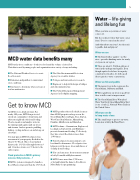
Water – life-giving
and lifelong fun
When you turn on your faucet, water comes out.
But do you know where that water comes from? Does it come from the river?
And what about our rivers? Are they safe to paddle, fish and play in?
Water we use
n The buried valley aquifer—not the river—provides drinking water for nearly everyone in our region
n There are about 1.5 trillion gallons of water in the underground aquifer. Even though aquifer levels have been pretty consistent for decades, it’s still a good idea to practice water conservation.
Water we fish and paddle
n The major rivers in the region are the Great Miami, Stillwater and Mad.
n Water quality in our rivers is good but there is still room for improvement.
n The Great Miami River Watershed Water Trail bit.ly/GreatMiamiWaterTrail is one of only 22 National Water Trails in the United States.
What you can do
to keep water clean
n Take small steps to protect our water. Learn how at bit.ly/BeWaterWise1.
