
Page 3 - 77456 ALPOA Newsletter 2021
P. 3
Annual Meeting
With much regret and an abundance of caution, your ALPOA officers and board felt it necessary to cancel last year’s annual meeting due to the Covid-19 pandemic. Unfortunately, we are still in similar circumstances this year. Although there are some signs of recovering from the pandemic, we cannot declare victory at this time. It is too early to determine the extent of recovery and what state health department Covid prevention guidelines may be in place.
The ALPOA Annual Meeting is tentatively scheduled for Saturday, July 17, 2021 at
10 a.m. More information will be forthcoming as we become aware of Covid-19 conditions and restrictions. We will post updated information on the ALPOA Facebook page and distribute flyers.
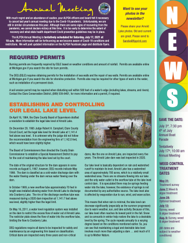
Want to see your photos in the newsletter?
Please share your Arnold Lake photos. Old and current are great. Please send to Sandie@fipprint.com
WE S
SAVE THE DATE:
July 3rd, 7:30 pm 4th of July Annual Boat Parade
Tentatively
July 17th, 10:00 am Annual Meeting
WEED CONTROL TREATMENT DATES
May 31:
Treatment survey
June 7: Weed & algae treatment
June 28:
Optional treatment
July 12:
Survey, weed
& algae treatment
Aug. 9: Survey, weed & algae treatment
(All dates are subject to weather conditions)
N
REQUIRED PERMITS
Burning permits are frequently required by EGLE based on weather conditions and amount of rainfall. Permits are available online at Michigan.gov if you search the site for burn permits.
The DEQ (EGLE) requires obtaining permits for the installation of sea walls and the repair of sea walls. Permits are available online at Michigan.gov if you search the site for shoreline protection. Permits also may be required for other types of work in the water, such as installation of a permanent dock.
A soil erosion permit may be required when disturbing soil within 500 feet of a water’s edge (including lakes, streams, and rivers). Contact the Clare Conservation District, (989) 539-6401, for more information and a permit, if required.
ESTABLISHING AND CONTROLLING
OUR LEGAL LAKE LEVEL
On April 16, 1964, the Clare County Board of Supervisors drafted a resolution to establish the legal lake level of Arnold Lake.
On December 29, 1965 Judge Robert H. Campbell, Clare County Circuit Court, set the legal lake level for Arnold Lake at 1,141.4 feet above sea level. It is unknown why the judge did not follow the recommendation from the engineering firm of 1,142.0 feet, which would have been slightly higher.
The Board of Commissioners then directed the County Drain Commissioner to establish a Special Assessment District to pay for the cost of maintaining the lake level set by the court.
The date of the original structure for the dam appears in some records as August 5, 1967, however, DEQ records indicate May 1966. The dam is classified as a cold-water discharge dam with the water flowing under the dam versus water flowing over the dam.
In October 1969, a new overflow tube approximately 70 feet in length was installed allowing water from Arnold Lake to discharge into Cranberry Lake. The rim of the discharge overflow tube was measured during a 2020 dam inspection at 1,141.7 feet above sea level, slightly higher than the legal limit.
On May 16, 2011, a water level regulation system was installed on the dam to restrict the excess flow of water out of Arnold Lake. The restrictor plate slows the flow of water into the overflow tube, limiting the flow to Cranberry Lake.
DEQ regulations require all dams to be inspected for safety and maintenance by an engineering firm based on classification. Critical dams are inspected every three years and non-critical
dams, like the one on Arnold Lake, are inspected every five years. The Arnold Lake dam was last inspected in 2020.
Our lake level is basically dependent on rain and watershed runoff to maintain its level. Arnold Lake has a watershed
area of approximately 700 acres, which is a relatively small watershed area. There are no streams flowing into our lake and the only water outlet is the overflow tube at the lake level control dam. It is speculated there may be springs feeding water into the lake; however, the existence of springs is not documented by any authoritative source. The lake level also is affected by evaporation due to sun, wind, and wave action.
This means that when rain is minimal, the lake level can decrease significantly (especially as the summer progresses) due to warm weather, sun, and lake activity. Because of this, our lake level often reaches its lowest point in the fall. Snow and ice amounts in winter help restore the lake to a desirable level by the spring. The cycle repeats annually to a varying degree based on the conditions mentioned earlier. So, you can see that maintaining a legal and desirable lake level involves much more than adjusting a dam ... and much of it is up to Mother Nature.
