
Page 56 - BENTLEY PR REPORT - AUGUST 2025
P. 56
8/6/25, 3:05 PM Abu Dhabi embraces micromobility with advanced digital planning
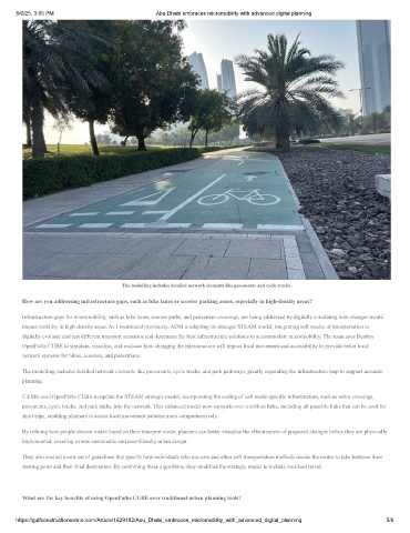
The modelling includes detailed network elements like pavements and cycle tracks.
How are you addressing infrastructure gaps, such as bike lanes or scooter parking zones, especially in high-density areas?
Infrastructure gaps for micromobility, such as bike lanes, scooter paths, and pedestrian crossings, are being addressed by digitally simulating how changes would
impact mobility in high-density areas. As I mentioned previously, ADM is adapting its strategic STEAM model, integrating soft modes of transportation to
digitally evaluate and test different transport scenarios and determine the best infrastructure solutions to accommodate micromobility. The team uses Bentley
OpenPaths CUBE to simulate, visualise, and evaluate how changing the infrastructure will impact local movement and accessibility to provide better local
network systems for bikes, scooters, and pedestrians.
The modelling includes detailed network elements like pavements, cycle tracks, and park pathways, greatly expanding the infrastructure map to support accurate
planning.
CitiME used OpenPaths CUBE to update the STEAM strategic model, incorporating the coding of soft mode-specific infrastructure, such as zebra crossings,
pavements, cycle tracks, and park paths, into the network. This enhanced model now supports over a million links, including all possible links that can be used for
short trips, enabling planners to assess local movement patterns more comprehensively.
By refining how people choose routes based on their transport mode, planners can better visualise the effectiveness of proposed changes before they are physically
implemented, ensuring a more sustainable and user-friendly urban design.
They also created a new set of guidelines that specify how individuals who use cars and other soft transportation methods decide the routes to take between their
starting point and their final destination. By combining these algorithms, they modified the strategic model to include localised travel.
What are the key benefits of using OpenPaths CUBE over traditional urban planning tools?
https://gulfconstructiononline.com/Article/1629182/Abu_Dhabi_embraces_micromobility_with_advanced_digital_planning 5/6