
Page 25 - 2001 AMA Summer
P. 25
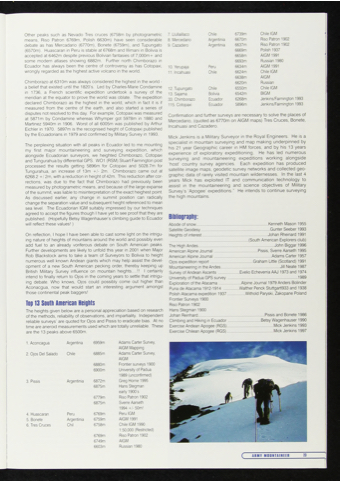
 Other peaks such as Nevado Tres cruces (6758m by photogrametric means, Riso Patron 6769m, Polish 6630m) have seen considerable debate as has Mercadario (6770m), Bonete (6759m), and Tupungato (6570m). Huascaran in Peru is stable at 6768m and Illimani in Bolivia is accepted at 6462m despite previous Bolivian fantasies of 7,000m + and some modern atlases showing 6882m. Further north Chimborazo in Ecuador has always been the centre of controversy as has Cotopaxi, wrongly regarded as the highest active volcano in the world.
Chimborazo at 6310m was always considered the highest in the world - a belief that existed until the 1820's. Led by Charles-Marie Condamine in 1736, a French scientific expedition undertook a survey of the meridian at the equator to prove the world was oblate. The expedition declared Chimborazo as the highest in the world, which in fact it is if measured from the centre of the earth, and also started a series of disputes not resolved to this day For example, Cotopaxi was measured at 5871m by Condamine whereas Whymper got 5978m in 1880 and Martinez 5940m in 1906. Worst of all 6005m was published by Arthur Eichler in 1970. 5897m is the recognised height of Cotopaxi published by the Ecuadorians in 1979 and confirmed by Military Survey in 1993.
7. Uullaillaco 8. Mercedario 9. Cazadero
10. Yerupaja 11. Incahuasi
12. Tupungato 13. Sajama
33. Chimborazo 115. Cotopaxi
Chile Argentina Argentinia
Peru Chile
Chile Bolivia Ecuador Ecuador
6739m 6670m 6637m 6669m 6658m 6693m 6634m 6624m 6638m 6620m 6550m 6542m 6268m 5896m
Chile IGM
Rlso Patron 1902
Riso Patron 1902
Polish 1937
AIGM 1991
Russian 1980
AIGM 1991
Chile IGM
AIGM
Russian
Chile IGM
BIGM Jenkins/Fairnington 1993 Jenkins/Fairnington 1993
. . . ... „ , j i ^ ~ ~
The perplexing situation with all peaks in Ecuador led to me mounting , K „ ,. ’ M. .... . , .. „ „ „
my first major mountaineering and surveying expedition, which
alongside Ecuadorian surveyors, we heighted Chimborazo, Cotopaxi
and Tungurahua by differential GPS. W01 (RSM) Stuart Fairnington post
processed the results getting 5896m for Cotopaxi and 5028.7m for host country survey agencies. Each expedition has produced
Tungurahua, an increase of 13m +/- 2m Chimborazo came out at 6268.2 + / 2m, with a reduction in height of 42m. This reduction after cor- rections, was due to the fact that Chimborazo had previously been measured by photogrametric means, and because of the large expanse of the summit, was liable to misinterpretation of the exact heighest point. As discussed earlier, any change in summit position can radically change the separation value and subsequent height referenced to mean sea level. The Ecuadorian IGM suitably impressed by our techniques agreed to accept the figures though I have yet to see proof that they are published. (Hopefully Betsy Wagenhauser's climbing guide to Ecuador will reflect these values!)
On reflection, I hope I have been able to cast some light on the intrigu- ing nature of heights of mountains around the world and possibly even add fuel to an already voriferous debate on South American peaks. Further developments are likely to unfold this year in 2001 when Major Rob Blackstock aims to take a team of Surveyors to Bolivia to height numerous well known Andean giants which may help assist the devel- opment of a new South American pecking order, thereby keeping up British Military Survey influence on mountain heights .!! I certainly intend to finally return to Ojos in the coming years to settle that intrigu- ing debate. Who knows, Ojos could possibly come out higher than Aconacgua, now that would start an interesting argument amongst those continental peak baggers!
... .. . . „ -.. Top 13 South American Heights
The heights given below are a personal appreciation based on research of the methods, reliability of observations, and impartiality. Independent reliable surveys’ are quoted for Ojos and Pissis to eradicate bias. At no time are aneroid measurements used which are totally unreliable. These are the 13 peaks above 6500m.
satellite image maps, geodetic survey networks and collected geo- graphic data of rarely visited mountain wildernesses. In the last years Mick has exploited IT and communication technology to assist in the mountaineering and science objectives of Military
1. Aconcagua
2. Ojos Del Salado
3. Pissis
4. Huascaran 5. Bonete
6. Tres Cruces
Argentina Chile
Argentinia
Peru Argentinia Chil
6959m 6885m
6880m 6900m
6872m 6875m
6779m 6875m
6769m 6759m 6758m
6769m 6749m 6603m
Adams Carter Survey, AIGM Mapping Adams Carter Survey, AIGM
Frontier surveys 1900 University of Padua 1989 (unconfirmed) Greg Horne 1995 Hans Stegman
early 1900’s
Riso Patron 1902 Sverre Aarseth
1994 +/- 50m!
Peru IGM
AIGM 1991
Chile IGM 1990 1:50,000 (Restricted) Riso Patron 1902 AIGM
Russian 1980
Confirmation and further surveys are necessary to solve the places of Mercedario, (quoted as 6770m on AIGM maps) Tres Cruces, Bonete. Incahuasi and Cazadero.
Mick Jenkins is a Military Surveyor in the Royal Engineers. He is a
specialist in mountain surveying and map making underpinned by his 21 Vear Geographic career inHM forces, and by his 3 yea s
experience of exp ora ory expe i lonmg
surveying and mountaineering expeditions working alongside
Survey s 'Apogee expeditions. the high mountains.
He intends to continue surveying
pihlinnpanhu-
BIDN0Qr3pny.
Abode of snow...................................................................Kenneth Mason 1955
Satellite Geodesy.............................................................. Gunter Seeber 1993 Heights of interest Johan Rheinard 1991 .......................................................................(South American Explorers club) The High Andes...................................................................... John Biggar 1996 American Alpine Journal Pissis, Sverre Aarseth 1995 American Alpine Journal .................................................... Adams Carter 1957 Qjos expedition report Graham Little (Scotland) 1991 Mountaineering in theAndes....................................................... Jill Neate 1987 Survey of Andean Ascents ....................Evelio Echeverria AAJ 1973 and 1974 university of Padua GPS survey ............................................................. 1989 Exploration of the Atacama.................... Alpine Journal 1979 Anders Bolinder puna de Atacama 1912-1914 ...............Walther Penck Stuttgartl933 and 1938 Polish Atacama expedition 1937................Withold Paryski, Zakopane Poland
FrontierSurveys1900 RlS0 Patron 1902
Hans Stegman 1900
Johan Reinhard............................................................ Pissis and Bonete 1986 Climbing and Hiking in Ecuador Betsy Wagenhauser 1990 Exercise Andean Apogee (RGS)..........................................Mick Jenkins 1993
Exercise Chilean Apogee (RGS)........................................Mick Jenkins 1997
( ARMY MOUNIAIHHB 23
4
v
