
Page 24 - 2001 AMA Summer
P. 24
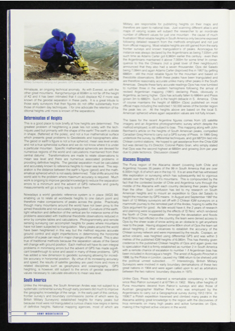
arrying out geodetic GPS surveys in the Atacama desert 1997.
Himalayas, an ongoing technical anomaly. As with Everest, so with the other great mountains. Kangchenjunga at 8598m is not far off the height of K2 and it has been intimated that it could displace K2 if more was known of the geoidal separation in these parts. It is a great tribute to those early surveyors that their figures do not differ substantially from those of modem day techniques. I for one advocate the retention of tra ditional heights until more is known of the separations.
Determination of Heights
This is a good place to look briefly at how heights are determined. The greatest problem of heightening a peak lies not solely with the tech niques used but primarily with the shape of the earth! The earth is oblate in shape, (flattened at the poles), and not a true mathematical surface which presents great problems to Geodesists and topographers alike. The geoid or earth's figure is not a true spheroid, mean sea level erratic and not a true spheroidal surface and we do not know where it is under a particular mountain. Specific mathematical spheroids are devised for numerous regions of the world and calculations maintained from their central datums'. Transformations are made to relate observations to mean sea level and there are numerous associated problems in providing definitive heights. The geoidal separation must be calculated and accurately known to reference heights to mean sea level. This sep aration is the distance between the earth’s figure (geoid) and the math ematical spheroid which is not easily determined. Tidal shifts around the world add to the problem where maximum accuracy is required. Much work is ongoing to improve geoidal knowledge to reduce the separation errors to a minimum and the advent of GPS networks and gravity measurements will go a long way to solve them.
Nowadays a world geodetic reference system is in place (WGS 84) enabling us to relate all worldwide heights to one datum point and therefore make comparisons of peaks across the globe. Practically though many mountains around the world have not been privy to the aimed theodolite and not accurately triangulated. Curvature of the earth, light refraction and deflection of the vertical are for instance some of the problems associated with traditional theodolite observations reduced in error by complex tables and calculations Photogrammetry and remote sensing surveying can accomplish heights for peaks where mountains have not been subjected to triangulation. Many peaks around the world have been heightened in this way but the method requires accurate ground control and slight imperfections in determining the horizontal position of a peak can result in major changes of the vertical. This is also true of traditional methods because the separation values of the Geoid will change with ground position. Each method will have its own integral problems in minimising errors but the advent of GPS has made signifi cant breakthrough to solve and assist in many of these problems. GPS has added a new dimension to geodetic surveying allowing for incredi ble accuracy in horizontal position. By virtue of its increasing accuracy and speed, the results of satellite geodesy are used more and more in related disciplines such as geophysics and oceanography. GPS heighting, is however, still subject to the errors of geoidal separation values necessary to calculate elevations to mean sea level.
South America
Unlike the Himalayas, the South American Andes was not subject to a systematic continental survey though early pioneers did much to improve the geographic knowledge of the range. In the early part of this century, frontier survey's and boundary commissions (some of which were by British Military Surveyors) established heights for many peaks but because most were not triangulated a curious chaos now reigns in terms of definitive heights. National mapping agencies, most of which are
Military, are responsible for publishing heights on their maps and therefore are open to national bias. Just scanning different atlas's and maps of varying scales will subject the researcher to an inordinate number of different values for just one mountain - the cause of much frustration! Most reliable heights in South America only become exposed following detailed research from the methods employed and not just from official mapping. Most reliable heights are still gained from the early frontier surveys and known triangulation’s of peaks. Aconcagua for instance was always declared by the Argentinians as being 7,035m until such time as Adams Carter got 6,960m earlier this century - even then the Argentinians maintained it above 7,000m for some time! In conse quence to this the Chileans (not a great lover of their neighbours!) announced that they also had a seven thousander, Ojos del Salado being 7.084m and again Adams Carter disproved this in 1957 by getting 6885m - still the most reliable figure for the mountain and based on theodolite observations. Both these peaks have been triangulated and are therefore reasonably accurate unlike many other peaks in the South Americas. Despite these fairly accurate readings Ojos has now tumbled to number three in the western hemisphere following the arrival of revised Argentinian mapping (1991) declaring Pissis, obviously in Argentina, as being higher. Ojos has actually fallen to 6864m and Pissis grown 3m to 6882m. Such is the height debacle in S. America. Chile of course maintains the height of 6893m (Ojos) published on most official maps including the restricted 1 50,000 series of the border region the peak lies on. All the heights above are based on the local S. American spheroid where again separation values are not fully known.
The basis for the recent Argentine figures comes from US satellite imagery and an Argentine photogrammetric survey which despite the method employed, is still subject to bias. This mapping along with John Reinhard’s article on the heights of South American peaks, compelled Canadian Greg Horne to carry out a GPS survey of Pissis. In 1995 Greg undertook the survey, by differential techniques, and got 6872m tied into Chilean control stations. He hoped to get assistance from the Chile IGM but was denied by it’s Director, Colonel Pablo Gran, who simply stated that Ojos was the second highest at 6893m and growing 2cm per year due to plate tectonics. Discussion closed!
Atacama Disputes
The Puna region of the Atacama desert (covering both Chile and Argentina) houses 35 peaks of the 99 in South America that are over 6,000m high, 6 of which are in the top 10. It is an area that has witnessed little exploration or surveying which has subsequently led to vigorous debate over the heights of it’s mountains. This is compounded by the fact that the contested border of Chile and Argentinia runs through the middle of the Atacama with each country declaring their peaks higher than the other. Such confusion has led to my research on South American heights and to mount an expedition to Ojos del Salado to height the mountain by GPS means. In August and September 1997 the team of 12 Military surveyors set off with 2 Chilean IGM surveyors on a mammoth journey to the remotest part of the Andes, hoping to settle the Ojos argument for good. As fate would have it, the 2 years of research and planning were scuppered by the effects of El Nino' which rendered the North of Chile 'impassable’. Amongst the devastation and floods that El Nino had inflicted on the country, the team were denied access to Ojos by the sheer scale of snow acting as an obstacle to get anywhere near to the peak. Having stopped some 80km short of Ojos the team set about heighting 2 other volcanoes to establish the accuracy of the Chilean survey network and were impressed by the results. Copiapo, an active volcano, was heighted using differential GPS and was within 3 metres of the published IGM heights of 6,080m. This has thereby given credence to the published Chilean heights of Ojos and again gives rise to speculation that it is firmly established as number 2 in South America with a remote chance of escalation to number 1 if Argentinian bias has been included in Aconcagua's height. The arrest of Augusto Pinochet in 1998, by the Police in London, caused my 1998 return to be shelved until the political unrest subsided . ...!!! Interestingly, British Military Surveyors were involved in early boundary demarkations of these two great nations in 1904 and were again called upon to act as arbitrators between the two nations' boundary disputes in 1970.
Unlike Ojos, Pissis had retained a remarkable consistency in height since Riso Patron surveyed it at 6779m in 1902. Many other heights of Puna mountains decend from Patron’s surveys and also those of Austrian geographer Walther Penck who was employed by the Argentinians to carry out a Geographical survey during 1912-1914. In 1936/7 a Polish expedition traversed and climbed many peaks in the Atacama adding great knowledge to the region with the discoveries of Inca remnants on many high peaks and active fumaroles on Ojos, making it the highest active volcano in the world.
n DHMIf MDUNTAIHf[R )
