
Page 220 - THE MELANESIA DIASPORA FILE CETAK ISI 10022017
P. 220
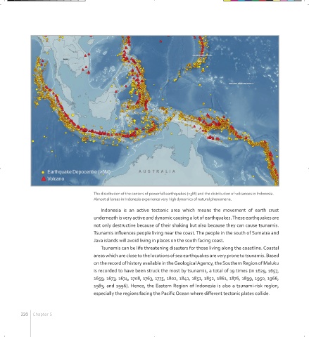
The distribution of the centers of powerfull earthquakes (>5M) and the distribution of volcanoes in Indonesia.
                                      Almost all areas in Indonesia experience very high dynamics of natural phenomena.
                                         Indonesia is  an active tectonic  area  which  means the movement  of earth crust
                                      underneath is very active and dynamic causing a lot of earthquakes. These earthquakes are
                                      not only destructive because of their shaking but also because they can cause tsunamis.
                                      Tsunamis influences people living near the coast. The people in the south of Sumatra and
                                      Java islands will avoid living in places on the south facing coast.
                                         Tsunamis can be life threatening disasters for those living along the coastline. Coastal
                                      areas which are close to the locations of sea earthquakes are very prone to tsunamis. Based
                                      on the record of history available in the Geological Agency, the Southern Region of Maluku
                                      is recorded to have been struck the most by tsunamis, a total of 19 times (in 1629, 1657,
                                      1659, 1673, 1674, 1708, 1763, 1775, 1802, 1841, 1851, 1852, 1861, 1876, 1899, 1950, 1966,
                                      1983, and 1996). Hence, the Eastern Region of Indonesia is also a tsunami-risk region,
                                      especially the regions facing the Pacific Ocean where different tectonic plates collide.


         220  Chapter 5


     MELANESIA BOOK FA LAYOUT 051216.indd   220                                                                 2/10/17   2:11 PM