
Page 14 - NYS_ESS_11-2025
P. 14
e
t
y
Mad
h
r
of
e
P
e
c
s
T
h
o
g
n
ol
e
Ob
s
y
or
ol
e
?
e
t
i
onal
s
s
S
v
e
u
r
Ha
Has Technology Made the Professional Surveyor Obsolete?
By Blake Collins, P.S.
I am constantly astounded by the technology that surrounds us daily. Reason 1. Accuracy of the Equipment
We carry computers in our pockets, and there are cameras in our Most GPS-enabled smartphones have an accuracy of around 16
doorbells and thermostats that adjust the temperature in your house feet under ideal circumstances (https://www.gps.gov/systems/gps/
based on whether or not you are at home. performance/accuracy/). That accuracy can decrease dramatically if
Surveying is one of the industries that has benefited from technological there are buildings or trees nearby. Again, the technology that allows
advancements. Virtual reference networks for our GPS equipment, you to pinpoint your location anywhere in the world to within 16
drones collecting lidar data, and scanners that will mount to the back of feet is imply mind blowing.
your truck are all incredible advancements that many surveyors take That level of accuracy is great if you are turned around in the woods
advantage of every day. There is also GPS and LiDAR built into our phones. and need to find your way back to your vehicle or if you are trying to
So now that the technology that surveyors use is also used by the find that trendy new restaurant. However, it is not nearly accurate
majority of the people around us, the question must be asked, “Has enough for determining the location of a property line, which can
technology made the professional surveyor obsolete?” affect your tax bill or how well you get along with your neighbor.
While web-based GIS applications showing land parcels have been By contrast, most modern survey equipment can achieve GPS
used for many years – by county tax assessors, in particular – the accuracies of +/- ½ inch.
transition to mobile device-based apps with GPS integration is a bit
newer. Now, with the correct device and app, anyone can look at a map Reason 2. Accuracy of the Data
that shows an aerial photograph and property lines together with a tiny The data represented in most of the apps that offer these services are
blue dot indicating their position and instantly be standing “at their obtained from county tax assessors. In essence, it is a tax map of the
property corner.” With such astounding technology, why do we need to area. Tax maps are generally a decent indicator of the general size and
pay professional surveyors for services that anyone with a GPS-enabled shape of the parcel of land involved. Sometimes, they even have a good
cell phone and the correct app can perform on their own? location when you compare it to aerial imagery obtained through Bing
or Google Maps. However, on most of the tax assessor’s websites, you
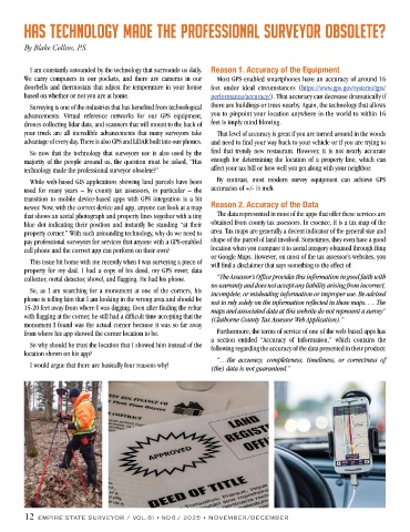
This issue hit home with me recently when I was surveying a piece of will find a disclaimer that says something to the effect of:
property for my dad. I had a copy of his deed, my GPS rover, data
collector, metal detector, shovel, and flagging. He had his phone. “The Assessor’s Office provides this information in good faith with
no warranty and does not accept any liability arising from incorrect,
So, as I am searching for a monument at one of the corners, his incomplete, or misleading information or improper use. Be advised
phone is telling him that I am looking in the wrong area and should be not to rely solely on the information reflected in these maps. … The
15-20 feet away from where I was digging. Even after finding the rebar maps and associated data at this website do not represent a survey”
with flagging at the corner, he still had a difficult time accepting that the (Claiborne County Tax Assessor Web Application).”
monument I found was the actual corner because it was so far away
from where his app showed the corner location to be. Furthermore, the terms of service of one of the web-based apps has
a section entitled “Accuracy of Information,” which contains the
So why should he trust the location that I showed him instead of the following regarding the accuracy of the data presented in their product:
location shown on his app?
“…the accuracy, completeness, timeliness, or correctness of
I would argue that there are basically four reasons why! (the) data is not guaranteed.”
12 EMPIRE STATE SURVEYOR / VOL. 61 • NO 6 / 2025 • NOVEMBER/DECEMBER