
Page 23 - NYS_ESS_09-2021
P. 23
free liberty of cutting timber for the use of His Majesty, or
that of the garrisons, in any other part of their country, not
comprehended herein.”
This was the first tract of land to which the Indian title was extinguished
in Western New York. The story continues through a tale of honor,
integrity and dedication through the perilous Revolution, leading to
the opening of New York’s last wilderness. Few people understand the
reasons why a consortium of Dutch banking houses had such power
over this district.
Here I will divert from further detail as I am honored to present a
more detailed discussion of the Mile Reserve and The Holland Land
Survey (first attempt at a rectangular survey system on which President
Jefferson built the US Rectangular Survey design, at our conference at
Turning Stone in January). See you there.
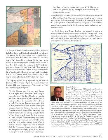
To bring this element of the story to fruition, Pontiac’s
Rebellion failed and England subdued all the players.
The Senecas, for their part, several years later ceded their
interest in a strip of land four miles wide, two on either
side of the Niagara River, to Great Britain. Later, when
the US won their independence, the two miles in what is
now New York became the property of the US and they
gave control to the State of New York. Thus, although
adjusted to just one mile in width, this gave birth to the
New York State Mile Reserve, one mile wide from Lake
Erie to Lake Ontario, which even today has unique title
source compared to the rest of Western New York.
The language of the Treaty negotiated by Sir William
Johnson; Chief Indian Agent for Great Britain at
Johnson Hall near Amsterdam, NY, on April 3, 1764
included this legal description: About the Author:
Kenneth M. Slaugenhoupt, PLS (retired), was licensed to
“To His Majesty, and His successors forever, practice Land Surveying in July 1974. He started surveying
in full right, the lands from Fort Niagara; in 1964, fresh out of high school with Harry R. Feldman of
comprehending the Petit-Marais, or landing Boston, MA. The firm had provided key QA/QC assurance
during the construction of the Niagara Power Project in
place, and running from thence southerly about Niagara Falls, NY. After joining Feldman, Ken was Chief
fourteen miles to the creek above Fort Schlosser of Party for the construction of the Blenheim-Gilboa Pumped
or Little Niagara, and down the same to the river, Storage Power Plant in Gilboa, NY. Later he served on the Real Estate Staff of the
or strait, and across the river, or strait, at the great NYSPA as Director of Property Negotiations. In 1979, Ken left PASNY and joined the
Land Survey Firm of Frank T. Tripi and Assoc. in Lewiston, NY. Ten years later, Ken
cataract; thence northerly to the banks of Lake purchased the firm and renamed it Niagara Boundary and Mapping Services, LSPC.
Ontario, at a creek, or small lake about two miles Ken retired from private practice in 2001 and joined Trimble Navigation LTD for
west of the fort; thence easterly along the banks twelve years, providing sales planning and leadership from Montana to Newfoundland,
of Lake Ontario, and across the river, or strait, CA. He retired from Trimble in 2012. Ken is Past President of the Niagara Frontier
Land Surveyors Association in WNY. He has served as Treasurer, Secretary, Vice-
to Fort Niagara; comprehending the whole President and Executive Vice President of the New York State Association of Professional
carrying place, with lands on both sides of the Land Surveyors. Ken is retiring again this year and will lead a busy retirement in
strait (or river), and containing a tract of about Lewiston, NY with his wife of 56 years, Esther. Ken is a past Senior Right of Way Agent
fourteen miles in length and four in breadth. with the International ROW Association. He was a certified instructor to IRWA and
And the Senecas do engage never to obstruct has presented many courses over the range of his career.
the passage of the carrying place, or the free use
of any part of said tract; and will likewise give
EMPIRE STATE SURVEYOR / VOL. 57 • NO 5/ 2021 • SEPTEMBER/OCTOBER 21