
Page 222 - Python for Everybody
P. 222
210 CHAPTER 16. VISUALIZING DATA
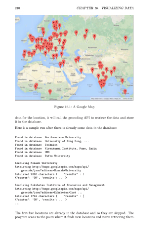
Figure 16.1: A Google Map
data for the location, it will call the geocoding API to retrieve the data and store it in the database.
Here is a sample run after there is already some data in the database:
Found in database Northeastern University
Found in database University of Hong Kong, ... Found in database Technion
Found in database Viswakarma Institute, Pune, India Found in database UMD
Found in database Tufts University
Resolving Monash University
Retrieving http://maps.googleapis.com/maps/api/
geocode/json?address=Monash+University Retrieved 2063 characters { "results" : [ {'status': 'OK', 'results': ... }
Resolving Kokshetau Institute of Economics and Management Retrieving http://maps.googleapis.com/maps/api/
geocode/json?address=Kokshetau+Inst ... Retrieved 1749 characters { "results" : [ {'status': 'OK', 'results': ... }
...
The first five locations are already in the database and so they are skipped. The program scans to the point where it finds new locations and starts retrieving them.
