
Page 8 - 11054Hwy279BentonvilleEMag
P. 8
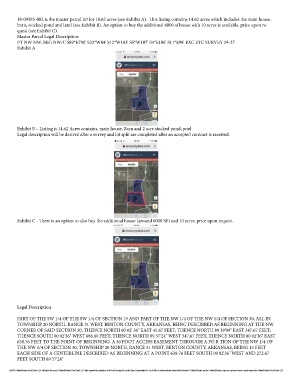
18-09985-002 is the master parcel ID for 18.62 acres (see Exhibit A).  This listing contains 14.62 acres which includes the main house,
        barn, stocked pond and land (see Exhibit B). An option to buy the additional 6000 sf house with 10 acres is available, price upon re-
        quest (see Exhibit C).
        Master Parcel Legal Description:
        PT NW NW, BEG NW/C S89*E790' S32*W84' S12*W103' S5*W107' S4*E106' S11*E98' EXC ETC SURVEY 19-27
        Exhibit A


        Exhibit B – Listing is 14.62 Acres contains, main house, Barn and 2 acre stocked pond, pool
        Legal description will be derived after a survey and lot split are completed after an accepted contract is received.


        Exhibit C - There is an option to also buy the additional house (around 6000 SF) and 10 acres, price upon request.


        Legal Description

        PART OF THE SW 1/4 OF THE SW 1/4 OF SECTION 19 AND PART OF THE NW 1/4 OF THE NW 1/4 OF SECTION 30, ALL IN
        TOWNSHIP 20 NORTH, RANGE 31 WEST, BENTON COUNTY, ARKANSAS, BEING DESCRIBED AS BEGINNING AT THE NW
        CORNER OF SAID SECTION 30; THENCE NORTH 00 02' 36" EAST 45.67 FEET; THENCE NORTH 89 39'09" EAST 347.67 FEET;
        THENCE SOUTH 00 02'36" WEST 686.80 FEET; THENCE NORTH 89 57'24" WEST 347.67 FEET; THENCE NORTH 00 02'36" EAST
        638.76 FEET TO THE POINT OF BEGINNING. A 30 FOOT ACCESS EASEMENT THROUGH A PO R TION OF THE NW 1/4 OF
        THE NW 1/4 OF SECTION 30, TOWNSHIP 20 NORTH, RANCE 31 WEST, BENTON COUNTY, ARKANSAS, BEING 15 FEET
        EACH SIDE OF A CENTERLINE DESCRIBED AS BEGINNING AT A POINT 638.76 FEET SOUTH 00 02'36" WEST AND 272.67
        FEET SOUTH 89 57'24"

     ©2016 Coldwell Banker Real Estate LLC. All Rights Reserved. Coldwell Banker Real Estate LLC fully supports the principles of the Fair Housing Act and the Equal Opportunity Act. Each Office Is Independently Owned And Operated. Coldwell Banker and the Coldwell Banker Logo are registered service marks owned by Coldwell Banker Real Estate LLC.