
Page 20 - High Knob Master Plan
P. 20
Mapping Tool
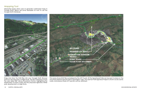
Interactive layers allow users to generate custimozed maps in Google Earth. Below are some examples on how to use the Google Earth Database
Drag and drop the KMZ files into your Google Earth Browser and tour the resources of High Knob. This first screenshot shows the view taken 862’ above Downtown Norton, highlighting the relationship of scenic roads and the proposed signature winter park development on High Knob.
ATV TOURIST
SPEARHEAD ATV TRAILS
LEEMAN PARK SIGNATURE PROJECT
SCENIC ROADS
PLACES TO BUY ATV PERMITS
20 CHAPTER 4: REGIONAL ASSETS
HIGH KNOB REGIONAL INITIATIVE
This scene shows KMZ files considered by the ATV Tourist. All the Spearhead Trails can be seen in place on the mountain behind Leeman Park in Pennington Gap. The Leeman Park Signature Project is shown as are scenic roads, and places where ATV permits can be obtained.
