
Page 102 - Louisiana Loop (manuscript Edition)
P. 102
According to my handy-dandy Navionics app I’m approximately river mile 225.8 which I find interesting because I
never could figure out the River Miles. It’s not like on the highway when you have road miles or signs, no, river miles
are (to me arbitrary) miles assigned by someone likely better suited for others than a Kayak or a person who doesn’t live
on the Mississippi River.
The Problem is you don’t start from 0 and go to the end or the beginning making 2333 river miles roughly. NOPE
somewhere at sometime someone felt special and restarted the numbers north and south sort of…..(don’t ask the
explanation is even worse than the facts and the history of it.
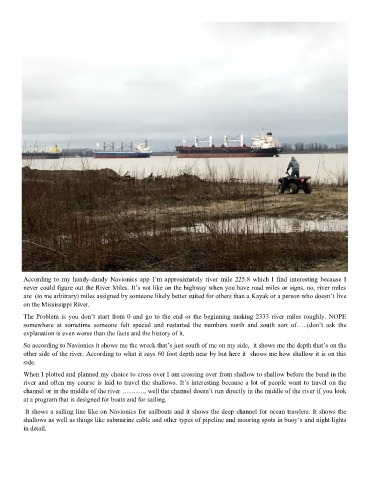
So according to Navionics it shows me the wreck that’s just south of me on my side, it shows me the depth that’s on the
other side of the river. According to what it says 60 foot depth near by but here it shows me how shallow it is on this
side.
When I plotted and planned my choice to cross over I am crossing over from shallow to shallow before the bend in the
river and often my course is laid to travel the shallows. It’s interesting because a lot of people want to travel on the
channel or in the middle of the river ………., well the channel doesn’t run directly in the middle of the river if you look
at a program that is designed for boats and for sailing.
It shows a sailing line like on Navionics for sailboats and it shows the deep channel for ocean trawlers. It shows the
shallows as well as things like submarine cable and other types of pipeline and mooring spots in buoy‘s and night lights
in detail.