
Page 26 - The Black Range Naturalist Vol. 4, No. 3
P. 26
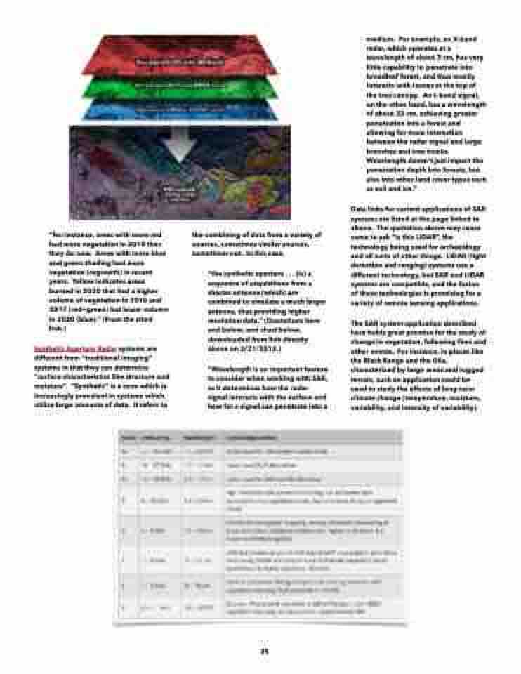
  “For instance, areas with more red had more vegetation in 2010 than they do now. Areas with more blue and green shading had more vegetation (regrowth) in recent years. Yellow indicates areas burned in 2020 that had a higher volume of vegetation in 2010 and 2017 (red+green) but lower volume in 2020 (blue).” (From the cited link.)
Synthetic Aperture Radar systems are different from “traditional imaging” systems in that they can determine “surface characteristics like structure and moisture”. “Synthetic” is a term which is increasingly prevalent in systems which utilize large amounts of data. It refers to
the combining of data from a variety of sources, sometimes similar sources, sometimes not. In this case,
“the synthetic aperture . . . (is) a sequence of acquisitions from a shorter antenna (which) are combined to simulate a much larger antenna, thus providing higher resolution data.” (Quotations here and below, and chart below, downloaded from link directly above on 2/21/2012.)
“Wavelength is an important feature to consider when working with SAR, as it determines how the radar signal interacts with the surface and how far a signal can penetrate into a
medium. For example, an X-band radar, which operates at a wavelength of about 3 cm, has very little capability to penetrate into broadleaf forest, and thus mostly interacts with leaves at the top of the tree canopy. An L-band signal, on the other hand, has a wavelength of about 23 cm, achieving greater penetration into a forest and allowing for more interaction between the radar signal and large branches and tree trunks. Wavelength doesn't just impact the penetration depth into forests, but also into other land cover types such as soil and ice.”
Data links for current applications of SAR systems are listed at the page linked to above. The quotation above may cause some to ask “is this LIDAR”, the technology being used for archaeology and all sorts of other things. LIDAR (light detection and ranging) systems use a different technology, but SAR and LIDAR systems are compatible, and the fusion of these technologies is promising for a variety of remote sensing applications.
The SAR system application described here holds great promise for the study of change in vegetation, following fires and other events. For instance, in places like the Black Range and the Gila, characterized by large areas and rugged terrain, such an application could be used to study the effects of long-term climate change (temperature, moisture, variability, and intensity of variability).
  25
