
Page 11 - The Silver Fire
P. 11
THE BLACK RANGE RAG - WWW.BLACKRANGE.ORG
The Silver Fire - As It Happened - Part 4 (Con’t)
This map (editor: see previous page) shows the fire progression since the beginning. (The green blob is the first map we got the day after the evacuation.) You can see the areas that were back-burned today, including Hillsboro Peak and an area Northwest of Kingston. The red outline at the top of the map is the border of the Aldo Leopold Wilderness.
The fire acreage. The last date should be 6/13. The last two days aren’t on her since the took the picture yesterday morning. There are new IR maps every day but they’re information is from the previous night. The fly-over for that is usually around 10:30 at night. (see image, page 8, top right)
From the INCIDENT ACTION PLAN
FIRE BEHAVIOR FORECAST: With relative humidities, winds, and cloud cover similar to Friday, fire behavior will be moderated again on Saturday. Fire will still be actively spreading in forested timber types with occasional individual and patches of group tree torching. Expect increases in rates of spread in the event of thunderstorm generated winds.
Specific Speed of Fire Spread
In ponderosa pine, mixed conifer, and dense canopy pinon/juniper:
Upslope: 11 ft/min Flanking: 1 ft/min Backing: . ft/min
Rates of Spread with gusts of 35 mph typical of T-storm downdrafts:
Upslope: 44 ft/min Flanking: 1 to 1 . ft/min. Backing: . ft/min.
SAFETY: Interior green islands and some burned areas in forested types are reburning. With outdrafts from thunderstorm winds, these interior flare ups can make pushes towards lines that are otherwise considered secure. Crews working to cold trail and hot spot the fires edge in Divisions A, Z and Tango must be especially diligent in posting lookouts who can monitor interior activity, and regularly reassess escape routes and safety zones.
Portable water tanks have been set up in Hillsboro. The helicopters dip from it with 300 gallon carriers. (see photo, page 9, top left)
I would like to keep one of the tanks for a swimming pool.
This is the fire camp on Highway 27 by Sterling Roberts’s place. The fire camp is being moved to a cooler, less windy location up Forest Road 157. (see photo, page 9, top center)
Fire workers in Kingston. That is Star Peak in the distance to the east. A nice ranger gave me these photos that he took up in Kingston today. I am working at the Community Center, and as I downloaded these for the blog, there were many folks who wanted to see them. This is the first time we have seen pictures of Kingston since the evacuation. (see photo, page 9, top right)
This is a backburn they did in Kingston today This is at Tom and Satomi’s house, looking north. (see photo, page 10, top left)
This is at Tom and Satomi’s. The hill burning is at or very near the old Boy Scout camp to the north. The fire has burned to the south and west of Kingston, here the north is having its fuel removed....so we are feeling safer and starting to talk about returning. We don’t know when that will be, though. (see photo, page 9, center top)
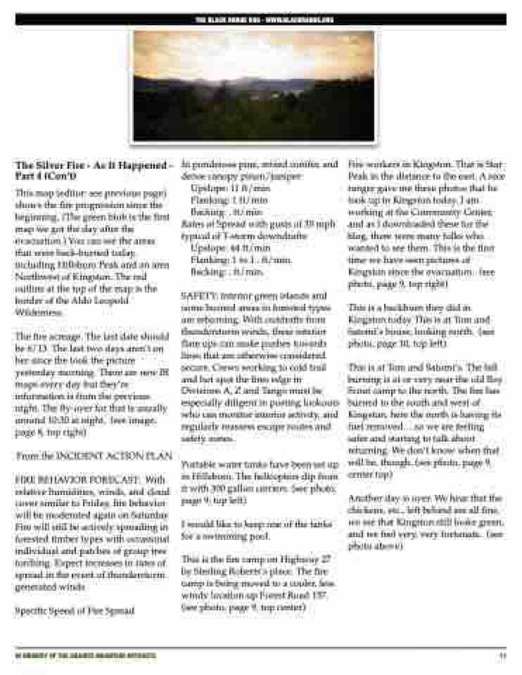
Another day is over. We hear that the chickens, etc., left behind are all fine, we see that Kingston still looks green, and we feel very, very fortunate. (see photo above)
IN MEMORY OF THE GRANITE MOUNTAIN HOTSHOTS
11
